The best drones for surveying are not automatically the biggest, newest, or most expensive. The right pick depends on what you actually need to deliver: a rough 3D model, construction progress maps, crop-health data, or survey-grade outputs that will stand up to professional scrutiny. This guide breaks down the best drones for surveying for beginners, creators, and working pros, with a focus on real workflow fit, upgrade path, and the mistakes that cause buyer regret.
Quick Take
If you want one short answer, this is it: for most people buying a serious survey drone today, the DJI Mavic 3 Enterprise is the safest all-around choice. It is compact, mapping-friendly, easier to deploy than larger enterprise systems, and strong enough for many construction, stockpile, and small-to-medium site jobs.
If your work is larger, more specialized, or more regulated, the best choice changes fast.
| Buyer type | Best pick | Why it stands out | Biggest caution |
|---|---|---|---|
| Beginner who wants a real survey workflow | DJI Mavic 3 Enterprise | Portable, practical, mechanical shutter, strong step-up from consumer drones | Still needs proper control, software, and compliance discipline |
| Creator who also needs occasional site models | DJI Mavic 3 Pro | Strong visual quality for content plus usable model capture in the right workflow | Not a survey-first platform; verify mapping app support |
| Large-area mapper | WingtraOne GEN II | VTOL fixed-wing efficiency for large open sites and corridors | Less convenient in tight or urban jobs |
| Professional photogrammetry team | DJI Matrice 350 RTK + Zenmuse P1 | High-throughput enterprise mapping with room to scale | Cost, logistics, and training are much higher |
| Professional LiDAR and terrain work | DJI Matrice 350 RTK + Zenmuse L2 | Better for vegetation, complex terrain, and surfaces where imagery struggles | LiDAR adds hardware, processing, and QA complexity |
| Agriculture and plant-health mapping | DJI Mavic 3 Multispectral | Compact platform for RGB plus multispectral field data | Niche tool if you do not truly need crop analytics |
Key points
- The best survey drone is a system, not just an aircraft.
- For most small and mid-size commercial jobs, a compact enterprise multirotor beats a huge platform.
- If your deliverables must be measurement-grade, prioritize shutter type, RTK or PPK support, software compatibility, and quality control over camera marketing.
- Fixed-wing pays off on large acreage. Multirotor wins on tight, repetitive, and mixed-location work.
- LiDAR is powerful, but it is not the default answer for every survey buyer.
- If your outputs will be used for legal boundary, cadastral, or licensed survey work, verify local professional licensing rules before you advertise services.
Start with the deliverable, not the drone
A lot of buyers say they need a “survey drone” when they really mean one of four different jobs:
-
Photogrammetry – Overlapping photos processed into an orthomosaic map or 3D model. – Best for construction sites, stockpiles, facades, roofs, mines, and open ground.
-
Topographic or measurable mapping – Similar capture, but with tighter accuracy requirements, stronger control, and better quality assurance. – Often needs RTK, PPK, ground control points, or all three.
-
LiDAR – Laser-based scanning that is often better for terrain under vegetation, utilities, and complex surfaces where photos alone struggle.
-
Multispectral or agricultural mapping – Specialized sensors that help assess plant health, drainage, stress, or field variability.
That matters because the wrong drone can still produce impressive-looking maps while being a poor business decision.
A fast buyer checklist before you spend anything
1. Define the output your client will pay for
Ask yourself:
- Do I need pretty visuals or measurable data?
- Am I delivering progress reports, volume calculations, terrain models, or crop analysis?
- Will a client use this for internal planning, or for regulated engineering or surveying work?
If the output must be defensible and repeatable, skip hobby-first thinking.
2. Match the drone to site size
- Small-to-medium sites: compact multirotors usually make the most sense.
- Large farms, mines, and corridors: fixed-wing starts to pay for itself.
- Dense vegetation or low-texture terrain: consider LiDAR rather than forcing photogrammetry to do everything.
3. Prioritize shutter, positioning, and workflow
Three terms matter early:
- Mechanical shutter: helps reduce image distortion during mapping runs.
- RTK: Real-Time Kinematic correction, which helps improve positioning consistency during capture.
- PPK: Post-Processed Kinematic correction, where positioning is refined after the flight.
A great-looking camera without the right workflow support can still be the wrong survey tool.
4. Confirm software compatibility before you buy
Do not assume your favorite drone, controller, and app stack will all work together.
Verify:
- mission-planning support
- geotagging workflow
- RTK or base-station compatibility
- processing software fit
- export formats your clients actually need
This matters even more if you want to use a creator drone for occasional mapping.
5. Think about downtime, not just purchase cost
For business buyers, the real cost is often:
- spare batteries
- chargers and field power
- repair turnaround
- calibration and QA workflow
- cloud or desktop processing
- staff training
- insurance and compliance overhead
A cheaper platform with poor service support can become expensive fast.
6. Be honest about your upgrade path
A smart first buy should still make sense 12 to 24 months from now.
- Beginners usually outgrow consumer drones faster than they expect.
- Creators often regret buying a pure survey platform if visual work still pays most of the bills.
- Pros regret underbuying when deadlines, vegetation, or team scaling show up.
The best drones for surveying by buyer type
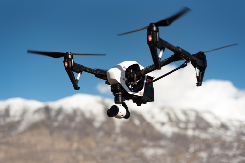
DJI Mavic 3 Enterprise
Best for most buyers, and the best first serious survey drone
For a huge share of real-world survey and mapping work, the DJI Mavic 3 Enterprise is the most balanced choice. It is the drone many beginners should buy if they are serious about surveying, and it is also the platform many working operators keep as their everyday field aircraft even after upgrading to larger systems.
Why it makes sense
- Compact and quick to deploy
- Mechanical-shutter camera suited to mapping workflows
- Optional RTK module for improved positional workflow
- Strong fit for construction, stockpiles, roofs, land development, and repeat progress jobs
- Easier transport and lower field friction than heavier enterprise aircraft
This is the drone that makes the most sense when you want real capability without instantly moving into full-size enterprise logistics.
Where it fits best
- solo operators
- small survey businesses
- construction progress teams
- engineering support crews
- buyers moving up from consumer drones
- firms that need a portable second aircraft
Why buyers regret skipping it
Many people try to save money by starting with a regular camera drone, then realize they still need better mapping consistency, better geotagging, better planning, and fewer workflow compromises. That often leads them back to the Mavic 3 Enterprise class anyway.
Skip it if
- most of your jobs are very large open tracts where fixed-wing is more efficient
- you need interchangeable payloads
- you already know LiDAR is central to your business
- your clients require a bigger enterprise workflow from day one
DJI Mavic 3 Pro
Best for creators who need occasional models, not survey-first deliverables
This is the hybrid pick. The DJI Mavic 3 Pro is not the best survey drone in a strict professional sense, but it can be the right drone for creators, media teams, real-estate marketers, tourism and land-promo teams, and visual operators who occasionally need site models or map-like deliverables.
Why it makes sense
- Strong visual quality for photo and video work
- Flexible focal lengths for storytelling and site marketing
- Useful for rough models, visual documentation, and context capture if your workflow supports it
- Better fit than a pure survey platform if creative work is still your main revenue
If 70 to 80 percent of your work is content creation and only a smaller share is model-building, a creator-first drone can be the smarter buy.
The important catch
A creator drone is not a survey-grade shortcut.
You need to verify:
- mission-planning support for your software stack
- whether your controller and region are supported
- whether rolling-shutter limitations are acceptable for your use case
- whether the client really needs accurate survey data rather than visual context
Best use cases
- promotional site overviews
- progress storytelling
- tourism and venue mapping visuals
- real-estate land packages
- early concept models for planning discussions
Skip it if
- measurement accuracy is the main reason you are buying
- you want regulated or sign-off-ready deliverables
- you will be billing for professional surveying outputs rather than creative documentation
WingtraOne GEN II
Best for large-area mapping and corridor-style work
If your jobs are big enough, fixed-wing efficiency changes the economics. The WingtraOne GEN II is one of the clearest examples of a survey platform that earns its place when acreage, coverage, and field efficiency matter more than compact portability.
Why it makes sense
- VTOL design reduces the runway hassle of traditional fixed-wing systems
- Strong fit for large fields, mines, open terrain, and corridor work
- Covers more ground efficiently than a multirotor on big sites
- Useful when reducing field time is a major business goal
Where it shines
- large topographic surveys
- mine mapping
- agriculture at scale
- infrastructure corridor capture
- repetitive large-site programs
What buyers need to understand
Fixed-wing sounds exciting, but it is not automatically a better buy.
It works best when:
- sites are open and large
- field teams can plan launches and recoveries carefully
- the business has enough large jobs to justify the workflow
If your bread and butter is construction pads, stockpiles, rooftops, and tight industrial sites, a fixed-wing can become an expensive mismatch.
Skip it if
- you work mostly in constrained urban or industrial environments
- you need frequent short flights across many small jobs
- your team is still learning basic survey operations
DJI Matrice 350 RTK + Zenmuse P1
Best for professional photogrammetry teams that need throughput and scale
Once you move into heavier professional work, the “drone” is really an aircraft-plus-payload system. The Matrice 350 RTK paired with the Zenmuse P1 is one of the strongest professional photogrammetry combinations for firms that need to scale operations, support repeat client work, and handle more demanding sites.
Why it makes sense
- Enterprise-grade multirotor platform
- RTK-focused workflow
- Interchangeable payload ecosystem
- P1 payload is purpose-built for high-end photogrammetry work
- Better for teams managing larger, more valuable, or more complex projects
Best fit
- survey and engineering firms
- utility contractors
- public works teams
- mining and quarry operators
- enterprise service providers
- crews that need repeatability across multiple pilots and sites
Why it is worth the jump for some buyers
Compared with compact enterprise drones, this kind of system can improve throughput, site flexibility, and long-term scaling. It also supports a more formal team structure when one pilot, one project manager, and one laptop are no longer enough.
The tradeoffs
- higher cost of ownership
- larger transport footprint
- more batteries, chargers, and field planning
- more training and standard operating procedures
- more painful downtime if support is weak
Skip it if
- you are still validating demand
- you mostly fly solo on smaller sites
- your deliverables do not justify full enterprise complexity
DJI Matrice 350 RTK + Zenmuse L2
Best for LiDAR, vegetation, and terrain that photogrammetry struggles with
When buyers ask whether LiDAR is “worth it,” the honest answer is usually: only if the work truly needs it. The Matrice 350 RTK with the Zenmuse L2 is a powerful option for firms dealing with vegetation, utility corridors, uneven terrain, or surfaces where imagery alone becomes unreliable.
Why it makes sense
- LiDAR is often better for terrain extraction under light to moderate vegetation
- Strong for utility, forestry, earthworks, and infrastructure workflows
- Useful where low texture, shadows, or surface uniformity can limit photo-based models
- Fits teams moving beyond standard RGB mapping
Where it pays off
- forestry and environmental work
- powerline and corridor mapping
- terrain capture in difficult conditions
- projects where clients need dense point-cloud outputs
What people underestimate
LiDAR is not just a more expensive camera. It changes the workflow.
You also need to think about:
- point-cloud processing
- calibration and validation
- file sizes and computing requirements
- client expectations around deliverables
- team skill level
For many small businesses, LiDAR becomes profitable only after the job pipeline is already proven.
Skip it if
- your work is mostly bare earth, roofs, and open sites
- you do not yet have consistent high-value demand
- you are trying to learn core mapping fundamentals on your first serious drone
DJI Mavic 3 Multispectral
Best for agriculture and plant-health surveying
The Mavic 3 Multispectral is a specialized tool, and that is exactly why it can be the right buy. If your work is field scouting, crop-health assessment, drainage pattern analysis, or agriculture-focused remote sensing, it makes a lot of sense in a compact package.
Why it makes sense
- Combines RGB and multispectral capture
- Better fit for agronomy and crop-monitoring workflows than a general mapping drone
- Portable and easier to deploy than larger specialty platforms
- Useful for growers, agronomists, and agricultural service providers
Best use cases
- crop stress detection
- field variability assessment
- orchard and vineyard monitoring
- agricultural trials
- repeat seasonal mapping
The catch
Multispectral is not automatically valuable just because the sensor exists. You need a real downstream use for the data. If you do not have a client, agronomy workflow, or decision-making process attached to those outputs, it can become an underused niche purchase.
Skip it if
- you mainly need topographic maps or construction models
- your business does not already serve agriculture
- you want one drone to do every type of surveying equally well
Safety, legal, and operational limits to know
Surveying with a drone is still flight activity, and in many places it is also regulated professional work.
Before you operate commercially, verify the rules that apply in your country or region for:
- drone registration and aircraft marking
- pilot credentials or competency requirements
- remote ID or equivalent electronic identification rules
- controlled or restricted airspace
- flying near people, roads, utilities, ports, or industrial sites
- privacy and data-collection obligations
- site-specific permissions from landowners or clients
- insurance expectations
- survey licensure or professional sign-off rules
One of the biggest global misunderstandings is this: a drone can produce very accurate-looking outputs, but that does not automatically mean you are legally allowed to market them as professional survey products in every jurisdiction.
That is especially important for:
- boundary work
- cadastral or land title work
- engineering sign-off
- government contract deliverables
- regulated mining or infrastructure projects
If you are unsure, verify with the relevant aviation authority and, where applicable, the local surveying or geospatial licensing body before taking paid work.
Common mistakes buyers make
1. Buying a camera drone and calling it a survey drone
A good camera is not the same thing as a good mapping workflow. A lot of frustration starts here.
2. Assuming RTK alone guarantees survey-grade results
RTK helps, but accuracy still depends on flight planning, overlap, terrain, control points, checkpoints, processing settings, and quality assurance.
3. Ignoring mechanical shutter and motion distortion
For some visual models, rolling shutter may be acceptable. For tighter mapping work, it is a compromise buyers often regret.
4. Underestimating software and data-processing costs
Storage, cloud processing, desktop hardware, training, and QA can matter as much as the aircraft.
5. Buying fixed-wing too early
If most jobs are small or constrained, fixed-wing efficiency on paper will not translate into day-to-day profit.
6. Jumping into LiDAR before the business case exists
LiDAR can be excellent, but it is usually a step after you already understand your market and have consistent demand.
7. Forgetting support, repairs, and spare parts
A grounded drone during peak season costs more than many buyers expect. Serviceability matters.
FAQ
What is the best drone for surveying overall?
For most buyers who want a serious, practical mapping platform without jumping into heavy enterprise complexity, the DJI Mavic 3 Enterprise is the strongest all-around pick. It fits a wide range of survey-style workflows and is easier to deploy than larger systems.
Can a regular camera drone be used for surveying?
Yes, for some visual mapping, rough models, and learning photogrammetry basics. But that does not make it the best choice for professional or measurement-focused work. Survey-grade reliability usually needs a better workflow than a consumer camera drone alone provides.
Do I need RTK for drone surveying?
Not always, but it becomes increasingly important as accuracy expectations rise. RTK improves positional workflow, but it does not replace good mission planning, control, and validation. Some jobs can also benefit from PPK or ground control points.
Is LiDAR better than photogrammetry?
Not universally. LiDAR is often better for terrain under vegetation, utility corridors, and low-texture conditions. Photogrammetry is often more affordable and perfectly effective for many open-site mapping jobs. The better choice depends on the site and deliverable.
Which is better for surveying: fixed-wing or multirotor?
Use fixed-wing for large open areas where efficiency and coverage matter most. Use multirotor for smaller, tighter, more complex, or more repetitive sites. Most new survey businesses are better served by multirotor first.
Do I need a licensed surveyor to offer drone surveying services?
In some places, yes, especially for boundary, cadastral, or legally relied-upon survey products. In others, the drone operation and the professional survey sign-off are treated separately. Verify local licensing rules before offering services publicly.
What software should I plan for when buying a survey drone?
You should budget for both flight planning and data processing. Common needs include mission planning, RTK correction workflow, photogrammetry or point-cloud processing, file management, and client-ready exports. Always confirm your chosen drone is supported by your software stack before you buy.
Should beginners rent before buying?
Often, yes. If you are unsure whether your work really requires compact enterprise, fixed-wing, or LiDAR, renting or subcontracting a few jobs first can prevent a very expensive wrong purchase.
Final decision
If you want the safest all-around answer, buy the DJI Mavic 3 Enterprise. If you are mainly a creator, buy a creator-first drone only when you are honest that your mapping needs are occasional and non-critical. If you are already running serious client work, choose between Wingtra for large-area efficiency, the Matrice 350 RTK plus P1 for professional photogrammetry, or the Matrice 350 RTK plus L2 for LiDAR-heavy jobs.
The best next step is simple: write down your deliverable, your average site size, and the software you plan to use. Once those three are clear, the right survey drone usually becomes obvious.