RTK drones vs standard GPS drones is not really a battle between “pro” and “beginner” hardware. It is a question of whether you need a drone for flying and creating, or a drone for producing position-sensitive data that other people will rely on. For most new pilots, creators, and general buyers, a standard GPS drone is the better value; for mapping, surveying, construction, and repeatable measurement work, RTK can be the smarter investment if you budget for the whole workflow.
Quick Take
If you want the fastest answer, here it is:
- Choose a standard GPS drone if your main goals are learning to fly, travel content, aerial photography, social media, real estate media, casual inspections, or general-purpose use.
- Choose an RTK drone if your work depends on accurate geotagging, repeatable site mapping, stockpile measurements, construction progress documentation, GIS-friendly outputs, or survey-adjacent deliverables.
- Standard GPS usually wins on budget because it leaves room for essentials like extra batteries, ND filters, storage, training, insurance, and editing software.
- RTK only makes sense when accuracy saves time or earns money through fewer revisits, less ground control setup, cleaner data alignment, or more credible deliverables.
- RTK does not automatically mean better photos, easier flying, or legal authority to perform survey work.
- If you are unsure, rent, borrow, or subcontract one RTK job first before buying a full system.
At-a-glance comparison
| Factor | Standard GPS drone | RTK drone |
|---|---|---|
| Best fit | Beginners, hobbyists, travel creators, photographers, real estate media, general inspections | Mapping teams, construction, stockpiles, utilities, infrastructure, survey-adjacent workflows |
| Main value | Easier buying decision, lower system cost, strong media capability | Better positional accuracy and repeatable geotagged outputs |
| Upfront cost | Lower | Higher |
| Hidden costs | Batteries, storage, filters, accessories, care plans | All of the left plus corrections, mapping software, training, QA workflow, possible base station or network fees |
| Learning curve | Mostly flight skills and camera workflow | Flight skills plus correction setup, mission planning, coordinate handling, quality control |
| Biggest regret risk | Outgrowing it if you later sell measurement-based services | Overpaying for accuracy you never actually use |
| Who should avoid it | Buyers needing defensible geospatial deliverables | Buyers who mostly want footage, photos, or casual flying |
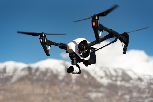
What RTK and standard GPS actually mean
Before you buy, it helps to strip away the marketing.
“Standard GPS drone” is buyer shorthand. In reality, most modern drones use multiple satellite systems, not just GPS. But the idea is simple: the drone uses satellite positioning for navigation, hovering, return-to-home, and geotagging photos. That is more than enough for most flying, filming, and general commercial content work.
“RTK” stands for Real-Time Kinematic. An RTK drone receives correction data from a known reference source, usually:
- a local base station on the ground, or
- a network correction service delivered over the internet
Those corrections reduce positioning error and improve the quality of the coordinates attached to images and flight data. In good conditions and with a proper workflow, that can produce much more accurate map outputs than a standard GPS-only workflow.
The important part is this: RTK improves positional accuracy and repeatability. It does not automatically improve:
- camera sensor quality
- dynamic range
- flight safety
- wind performance
- storytelling
- editing skill
- legal permission to do survey work
That is why many buyers overestimate RTK and underestimate how good a standard GPS drone already is for everyday flying.
Why budget changes the answer so much
A lot of buying mistakes happen because people compare only the aircraft price. That is the wrong comparison.
The real choice is between:
- a lower-cost drone system that gets you flying sooner, or
- a higher-cost data workflow that only pays off if you truly need the accuracy
When a standard GPS drone gives you more value
If your budget is limited, a standard GPS drone usually produces better real-world results because it lets you fund the full kit.
That extra money often goes toward things that matter more than RTK for most users:
- more batteries
- a better controller or display setup
- ND filters for smoother video
- spare props and cases
- training and certification costs
- editing software
- storage and backup drives
- insurance or repair coverage
For a travel creator, aerial photographer, or beginner pilot, those purchases will usually improve the outcome more than centimeter-level positioning ever will.
When RTK earns its keep
RTK starts making financial sense when accuracy saves labor, reduces rework, or unlocks higher-value deliverables.
That usually happens when you are doing work like:
- orthomosaics for construction progress
- topographic modeling
- stockpile volume calculations
- site planning support
- recurring inspection flights over the same assets
- asset inventories tied to GIS systems
- corridor or infrastructure mapping
In those cases, better positioning can mean:
- fewer ground control points
- faster field setup
- more reliable alignment between flights
- fewer return visits
- less argument over measurement quality
- cleaner handoff to engineers, GIS teams, or clients
The hidden costs of RTK that buyers forget
RTK is rarely just “buy the drone and go.”
You may also need:
- A correction source: local base station or network RTK service
- Mapping software: for planning flights and processing outputs
- Data storage and computing: mapping files get large fast
- Training: especially if your team is new to mapping workflows
- Quality assurance checks: checkpoints, logs, repeatability reviews
- Regional support: local dealer help, repair channels, firmware guidance
That is why some buyers should not jump straight to RTK even if they think they might want it “someday.”
Which drone type fits which goal?
This is where the decision usually becomes clear.
If your goal is learning to fly
A standard GPS drone is the better buy.
Why:
- lower financial pressure while learning
- easier to focus on basic piloting, situational awareness, and camera habits
- less workflow complexity
- fewer technical dependencies in the field
New pilots tend to learn faster when they are not also dealing with correction status, map planning, coordinate systems, and data validation.
If your main challenge is still “Can I launch, frame, return safely, and build confidence?” RTK is usually too much, too soon.
If your goal is travel content, YouTube, or social media
A standard GPS drone is almost always the better fit.
Travel creators benefit more from:
- portability
- battery efficiency
- strong photo and video performance
- simple setup in changing locations
- faster deployment at sunrise, sunset, or short stopovers
RTK usually adds cost and workflow complexity without meaningfully improving your content.
For this kind of buyer, a better camera, extra batteries, or better editing discipline matters far more than precise geotags.
If your goal is aerial photography or videography
Again, standard GPS is usually the smarter purchase.
RTK does not make your footage sharper or your photos more cinematic. If your deliverable is visual, not measured, RTK is often wasted money.
That includes many common commercial gigs:
- hotel and resort content
- destination marketing
- real estate listing media
- automotive shoots
- wedding venue overviews
- tourism and lifestyle content
The exception is when you are mixing media capture with repeatable mapping or asset documentation.
If your goal is real estate marketing
For most real estate creators, standard GPS is enough.
You mainly need:
- stable flight
- safe operation around homes and streets
- strong photo and video quality
- quick setup and breakdown
- dependable return-to-home and obstacle awareness
RTK only becomes relevant if you are doing larger land-development workflows, site planning visuals, or map-based deliverables beyond ordinary listing content.
If your goal is inspection work
This depends on what “inspection” means.
Standard GPS is enough for many visual inspections
If your job is mainly to capture close visuals of:
- roofs
- facades
- towers
- solar panels
- gutters
- basic structural issues
then standard GPS often works fine.
The client may care more about image clarity, safe flight, and good reporting than ultra-precise coordinates.
RTK helps when inspections feed systems, not just reports
RTK becomes more useful when you need:
- repeatable flights over the same infrastructure
- consistent defect location records
- GIS or asset-management integration
- measurement-driven maintenance workflows
- standardized site documentation over time
If you are building a business around infrastructure data, not just imagery, RTK can be worth the jump.
If your goal is mapping, surveying, or construction documentation
This is where RTK usually wins.
If you are delivering:
- orthomosaics
- digital surface models
- terrain models
- stockpile calculations
- progress maps
- georeferenced site data
then RTK is often the better fit because it improves the positional quality of your image data and reduces friction in repeat missions.
That said, buyers should remember a few limits:
- RTK does not make every map automatically survey-grade
- poor mission planning still causes bad outputs
- heavy canopy, tall structures, weak correction links, or bad visibility can still affect results
- many high-accuracy workflows still use checkpoints or ground control for validation
If your client will make engineering, planning, or payment decisions from the data, accuracy claims should be handled carefully.
If your goal is stockpile measurement or earthworks tracking
An RTK drone is often a strong choice.
Why:
- repeatability matters
- measurement confidence matters
- positional consistency matters over time
This is one of the clearest cases where better geospatial accuracy can translate into real business value.
If your goal is agriculture
This one is mixed.
A standard GPS drone may be enough for:
- visual crop scouting
- media capture
- simple observation flights
An RTK drone may be the better choice for:
- repeatable field mapping
- survey-style crop analysis workflows
- data alignment across time
- integration with farm planning or precision agriculture systems
The decision depends on whether the operation is image-led or data-led.
If your goal is FPV flying
For most FPV pilots, neither the pitch nor the premium matters much.
Traditional FPV use cases focus on:
- manual control
- speed and agility
- freestyle
- racing
- cinematic chase work
RTK is usually irrelevant unless you are working in a very specialized industrial or research workflow. Most FPV buyers should put that budget into:
- safer batteries
- better goggles
- spare parts
- a simulator
- stronger maintenance habits
The learning curve: RTK is not harder to fly, but harder to use well
This is an important distinction.
An RTK drone is not necessarily much harder to pilot in the air. The harder part is everything around the flight.
With standard GPS, the learning curve is mostly:
- flight control
- preflight checks
- exposure and camera settings
- airspace awareness
- battery discipline
- safe recovery habits
With RTK, you add a workflow layer on top:
1. You need a correction source that actually works
That may mean a base station or a network correction service. If the connection drops, the workflow changes.
2. You need disciplined mission planning
Overlap, altitude, speed, terrain, and site coverage matter more when the output is a map, not just a photo.
3. You need to understand status and quality
It helps to know whether the system has a valid correction lock and whether the collected data is good enough for the job.
4. You need to think about coordinate handling
In plain English, this means understanding how your data is placed on the earth and whether that matches what your client or software expects.
5. You need quality control
Even with RTK, professionals often use checkpoints or validation steps. You cannot just assume the output is right because the aircraft is expensive.
If terms like “orthomosaic,” “checkpoint,” or “coordinate system” already sound intimidating, that is not a reason to avoid RTK forever. It is just a sign that you should buy it only when your work actually requires it.
Safety, legal, and compliance limits to know
Whether you buy RTK or standard GPS, the same basic rule applies: better positioning does not remove operational responsibility.
Keep these points in mind:
- Airspace, registration, pilot qualification, and local operating rules still apply.
- Automated mapping flights are still flights. You must manage people, property, weather, battery margins, and site hazards.
- Visual line of sight and local operating restrictions may still limit how missions are flown.
- Sensitive sites may have extra rules, including ports, power facilities, government areas, parks, heritage zones, and industrial compounds.
- Privacy and data handling laws still matter, especially when collecting images over private property or critical infrastructure.
- An RTK drone does not make you a licensed surveyor. In many places, legal boundary work, cadastral outputs, or formally certified measurements may require a licensed professional or additional approvals.
- If you work across borders, verify local rules for batteries, radio equipment, internet-based correction services, mobile connectivity, and any site-specific permits before travel.
The safe approach is simple: if the work affects property rights, engineering decisions, regulated infrastructure, or formal measurements, confirm local professional and aviation requirements before accepting the job.
Common mistakes buyers make
1. Buying RTK because it “sounds professional”
This is the most common mistake.
If your output is mainly visual, RTK often does nothing for your client. A cheaper drone with better accessories, more practice, and better editing can create more value.
2. Thinking RTK replaces ground control forever
RTK can reduce dependence on ground control in many workflows, but it does not eliminate validation needs. For critical jobs, checkpoints and QA still matter.
3. Ignoring correction coverage where you actually fly
Network corrections are not equally practical everywhere. Remote areas, unreliable connectivity, dense urban environments, or obstructed skies can complicate RTK performance.
4. Confusing drone accuracy with project accuracy
The aircraft may support RTK, but the final output still depends on:
- flight planning
- lighting and surface texture
- camera quality
- terrain
- processing settings
- operator discipline
5. Underbudgeting software and data management
Many buyers stretch for the aircraft and then discover the real workload begins after landing.
6. Choosing the drone before defining the deliverable
This is backwards. Start with what the client needs, then pick the system that meets that need.
A simple decision framework before you buy
If you want a clean decision, use this checklist.
1. What are you actually delivering?
- Photos and video?
- Inspection visuals?
- Marketing content?
- Measurable maps?
- Volume calculations?
- GIS-ready data?
If the answer is mostly visual, standard GPS is usually enough.
2. How much positional error can your work tolerate?
If “close enough” is fine, standard GPS is usually the better value.
If small location errors can break the job, RTK deserves serious consideration.
3. Will you revisit the same site often?
Repeatable, recurring site work increases the value of RTK.
One-off content shoots usually do not.
4. Do you have the workflow to support RTK?
Ask yourself:
- Do I have correction access where I fly?
- Do I have mapping software?
- Do I know how to validate outputs?
- Do I have local support or repair options?
If not, the purchase may be early.
5. Which mistake is more expensive for you?
- Buying too little and outgrowing it fast?
- Buying too much and never using the premium features?
Most individual buyers regret overbuying more than underbuying.
6. Could you test before committing?
A rental, dealer demo, or subcontracted RTK mission can save you from a costly mismatch.
FAQ
Do RTK drones take better photos or video?
Not by default. RTK improves positioning accuracy, not camera artistry. If your main goal is image quality, compare the camera system first.
Are RTK drones harder for beginners to fly?
Usually not dramatically harder in basic flight, but they are harder to use properly in a full workflow. The learning curve is more about setup, mission planning, and data quality than stick control.
Can I start with a standard GPS drone and upgrade later?
Yes, and for many buyers that is the smartest path. You can learn flight skills, build clients, and upgrade to RTK when your deliverables actually require it.
Do I still need ground control points with RTK?
Sometimes yes. RTK can reduce ground control needs, but checkpoints and validation are still important for accuracy-sensitive work, especially when clients rely on measurements.
What if I fly in places with poor mobile signal?
That can matter if your RTK workflow depends on internet-delivered corrections. In those cases, buyers should evaluate base station workflows or alternatives like post-processing approaches.
Is RTK worth it for roof, solar, or tower inspection?
Usually only if your inspection program needs repeatable geolocation, asset records, or map-based analysis. For many visual inspections, standard GPS is sufficient.
What is the difference between RTK and PPK?
RTK applies corrections during the flight. PPK, or Post-Processed Kinematic, applies corrections after the flight. PPK can be useful when live corrections are unreliable, but it is still part of a more advanced accuracy-focused workflow.
Can an RTK drone replace a surveyor?
No. An RTK drone is a tool, not a license. If the work involves legal boundaries, cadastral outputs, or formally certified measurements, verify whether a licensed survey professional is required in your jurisdiction.
Final decision
If your next year of flying is mostly about learning, creating, traveling, marketing properties, or producing visual deliverables, buy the standard GPS drone and spend the saved budget on batteries, training, safety, and workflow.
If your revenue depends on accurate maps, repeatable site data, volumes, progress tracking, or GIS-ready outputs, buy the RTK drone only when you can afford the full system around it.
If you are still on the fence, do one thing before purchasing: define the deliverable your clients will pay for. That answer will usually tell you which drone type belongs in your bag.