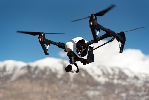
If you’re asking what is the best drone for forestry work, the honest answer is that there is no single best model for every forest job. The right choice depends on whether you need basic visual inspection, repeatable mapping, tree-health data, thermal search capability, or high-end LiDAR-style surveying. Forestry is also harder on drones than many buyers expect: you’re dealing with canopy, wind, steep terrain, remote logistics, and stricter operational risk than a simple open-field flight.
Quick Take
For most forestry buyers, the best drone is not the one with the most features. It is the one that fits your actual field workflow, your data needs, and your team’s skill level.
Best fit by use case
- Best overall for most forestry professionals: a compact enterprise mapping drone with RTK and a mechanical shutter, such as the DJI Mavic 3 Enterprise
- Best budget option for visual inspections and scouting: a compact camera drone such as the DJI Mini 4 Pro
- Best step-up budget option for better wind handling and visual coverage: the DJI Air 3
- Best for forest health monitoring and vegetation analysis: the DJI Mavic 3 Multispectral
- Best for thermal patrols, hotspot checks, and search-style missions: the DJI Mavic 3 Thermal or Autel EVO Max 4T
- Best for advanced enterprise forestry, large teams, or specialized payloads: the DJI Matrice 350 RTK with the right camera or sensor package
The shortest buying advice
- If you only need photos, video, and occasional site checks, start small.
- If you need maps you can measure and defend, buy an enterprise mapping drone.
- If you need plant health insight, buy multispectral only if you also have the software and expertise to use the data.
- If you need thermal, remember it helps with heat detection, not magic vision through trees.
- If you are considering LiDAR, you are already in enterprise territory and should budget for the whole workflow, not just the aircraft.
Key points before you buy
- Forestry work is really several different jobs under one label.
- A drone that is great for media capture can be a poor choice for accurate mapping.
- The biggest buying mistake is paying for a sensor you cannot process, interpret, or monetize.
- In forest environments, battery logistics, controller visibility, reliability, and recovery planning matter almost as much as the camera.
- Regulations vary widely by country, and forests may still be inside protected areas, restricted zones, or emergency response airspace.
What “forestry work” actually means
Before comparing models, define the output you need. That single step will save more money than hours of spec-sheet reading.
1. Visual inspection and documentation
This includes:
- trail checks
- access road inspection
- storm damage review
- harvest-area progress photos
- boundary and fence visibility
- media capture for reports or stakeholders
For this kind of work, a good camera, stable flight, and portability matter more than advanced sensors.
2. Mapping and measurement
This includes:
- orthomosaics
- terrain models
- road and skid trail planning
- stand mapping
- cut-block progress
- drainage and erosion review
- repeat surveys over time
For this, you want:
- repeatable flight planning
- strong GPS/GNSS performance
- preferably RTK for better positioning
- ideally a mechanical shutter to reduce motion distortion in mapping
3. Vegetation health and silviculture monitoring
This includes:
- regeneration monitoring
- stand vigor analysis
- stress detection
- planting success checks
- species or canopy pattern analysis
This is where multispectral sensors can help, but only if you understand how to turn those layers into decisions.
4. Thermal patrol and incident response
This includes:
- hotspot detection
- fire-edge awareness
- equipment heat issues
- nighttime search support
- wildlife or anti-poaching patrols in some contexts
For this, thermal is valuable, but it has limits. Dense canopy blocks a lot of useful thermal visibility.
5. Advanced canopy structure and survey-grade analysis
This includes:
- high-end topographic work
- corridor and infrastructure work in forested areas
- research projects
- dense vegetation penetration with LiDAR workflows
This is rarely a beginner purchase. It usually means enterprise budgets, trained crews, and heavier software demands.
Best drone type for each forestry task
| Forestry task | Best drone class | Good examples | Rough budget level |
|---|---|---|---|
| Site photos, trail checks, simple scouting | Compact camera drone | DJI Mini 4 Pro, DJI Air 3 | Entry to lower-mid |
| Better visuals, more wind confidence, regular inspections | Midrange camera drone | DJI Air 3, DJI Mavic 3 Classic | Lower-mid to mid |
| Mapping, orthomosaics, measured outputs | Compact enterprise mapping drone | DJI Mavic 3 Enterprise | Mid to upper-mid |
| Vegetation health, forest vigor, replanting analysis | Multispectral drone | DJI Mavic 3 Multispectral | Upper-mid to high |
| Thermal patrol, hotspot checks, search support | Thermal enterprise drone | DJI Mavic 3 Thermal, Autel EVO Max 4T | Upper-mid to high |
| LiDAR, advanced payloads, larger operations | Heavy enterprise platform | DJI Matrice 350 RTK and payload packages | High to very high |
Budget levels vary by country, taxes, bundle, batteries, and software. For forestry, the aircraft is usually only part of the real cost.
The features that matter most in forests
A forestry drone buyer can get distracted by headline features. In practice, these are the ones that matter most.
| Feature | Why it matters in forestry | Who should pay extra for it |
|---|---|---|
| RTK positioning | Improves repeatability and mapping accuracy | Survey, GIS, plantation, and enterprise teams |
| Mechanical shutter | Reduces motion blur and image distortion for mapping | Anyone producing orthomosaics regularly |
| Thermal camera | Useful for heat detection, fire-related work, search, and some inspections | Fire, patrol, utility, and safety-focused teams |
| Multispectral sensor | Helps analyze vegetation condition beyond visible RGB imagery | Foresters, agronomy-style teams, research users |
| Long battery ecosystem | Remote work often means fewer charging options and longer walks | Everyone |
| Bright controller screen | Forest edges, snow glare, and full sun make dim screens painful | Everyone who flies in daylight field conditions |
| Weather resistance | Moisture, dust, mist, and unpredictable field conditions matter | Frequent professional operators |
| Good zoom options | Helps inspect trees, slopes, roads, and hazards without flying too close | Inspection-focused users |
| Repair and support availability | Downtime hurts more when jobs are remote and time-sensitive | Commercial users |
| Planned-mission support | Essential for repeatable mapping and corridor work | Anyone doing data capture rather than casual flight |
A few features that matter less than buyers think
- Ultra-high video resolution, if your real deliverable is mapping
- Fancy cinematic color profiles, if your audience is a forester or GIS team
- Extreme top speed, unless you are chasing a very specific operational need
- “Obstacle avoidance” marketing, because thin branches and complex canopy are still hard for many systems
Best drone for forestry work by budget
The best way to buy is to match your budget to the type of result you need.
Under roughly $1,500: best for learning, scouting, and light visual work
If your forestry work mainly means visual inspection, simple documentation, and occasional stakeholder imagery, this budget can work.
Best fit: DJI Mini 4 Pro
Why it makes sense:
- highly portable for hikes and remote access
- easy to deploy quickly
- strong enough for simple forestry visuals
- useful for solo operators who need speed more than heavy data capture
Best for:
- woodland owners
- small conservation groups
- beginner operators
- trail managers
- field teams that need fast visual confirmation
What you give up:
- true enterprise durability
- mapping-grade workflow
- thermal
- multispectral
- better wind confidence compared with larger platforms
Better if you can stretch: DJI Air 3
Why many forestry buyers prefer stepping up:
- stronger all-around visual tool
- better wind handling than ultra-light drones
- more confidence for regular field use
- flexible camera setup for inspection-style work
Best for:
- repeat visual missions
- more demanding terrain
- operators who already know they will outgrow a mini drone quickly
Who will regret this budget band:
- anyone who needs measured maps
- anyone planning paid deliverables beyond basic imagery
- anyone assuming “small drone” automatically solves compliance
Roughly $1,500 to $5,000: the sweet spot for serious solo forestry work
This is where buying decisions start to matter more. If you are working professionally, this band is often the best value zone.
Best overall recommendation: DJI Mavic 3 Enterprise
For many forestry users, this is the answer to “what is the best drone for forestry work?”
Why:
- portable enough for field travel
- more professional workflow than consumer drones
- designed around real data capture, not just content creation
- strong fit for mapping, inspection, and repeat site documentation
- supports enterprise-style operations better than casual camera drones
Best for:
- forestry consultants
- land management teams
- GIS technicians
- timber operations needing repeat surveys
- businesses that need accurate maps without moving into heavy enterprise systems
Why it beats consumer drones for this job:
- more dependable fit for planned mapping missions
- better path into repeatable commercial workflow
- easier justification if you bill clients for outputs, not just flights
When not to buy it:
- if you only need occasional photos and will not use mapping features
- if you actually need thermal or multispectral instead
- if your team is not ready for data processing discipline
Roughly $5,000 to $15,000: job-specific forestry tools
At this level, you should buy for a specific mission, not general curiosity.
Best for thermal forestry work: DJI Mavic 3 Thermal or Autel EVO Max 4T
Choose a thermal platform if your work involves:
- hotspot checks
- post-fire assessment support
- safety patrols
- heat-related inspection tasks
- some search or wildlife-related missions, where legal and ethical
Why this class works:
- easier to deploy than large enterprise rigs
- much more practical than heavy platforms for routine fieldwork
- combines thermal with visible imaging
Important limit:
- thermal does not see through dense canopy the way many new buyers imagine
Best for vegetation analysis: DJI Mavic 3 Multispectral
Choose multispectral if your forestry work truly involves:
- plant stress comparison over time
- regeneration analysis
- forest health programs
- research-backed vegetation monitoring
- prescription-style management decisions
Why it can be worth it:
- combines visible and non-visible data capture
- suited to repeatable vegetation workflows
- much better fit than guessing health from standard RGB images alone
Who should avoid it:
- buyers who only want prettier maps
- teams without software or interpretation capability
- anyone hoping it will automatically produce management insight without planning
$15,000 and up: enterprise forestry, larger crews, specialized payloads
Best fit: DJI Matrice 350 RTK class systems
This class makes sense when you need:
- heavy or interchangeable payloads
- larger-scale operations
- advanced thermal, zoom, or LiDAR workflows
- enterprise fleet management
- deeper integration into surveying or infrastructure programs
Why it is powerful:
- scalable platform
- stronger payload options
- better for specialized missions and high utilization
Why it is a bad casual purchase:
- higher training burden
- bigger transport and charging demands
- more procedures, more maintenance, more cost
- overkill for basic forestry photo work
The LiDAR reality
If you are considering drone LiDAR for forestry, think beyond the aircraft.
You need to budget for:
- payload
- mission planning
- calibration
- data processing
- staff expertise
- storage and computing
- QA/QC, meaning quality assurance and quality control
LiDAR can be transformative for some forest structure and terrain work, but it is rarely the first drone a forestry team should buy.
Best drone for forestry work by skill level
Beginner: buy the simplest drone that still solves the job
Best fit:
- DJI Mini 4 Pro
- DJI Air 3
Choose this level if you are:
- learning to fly
- doing simple visual documentation
- testing whether drones will become a bigger part of your forestry workflow
Do not start with:
- thermal
- multispectral
- heavy enterprise platforms
- anything you cannot confidently operate, maintain, and insure where required
Beginner rule
If you cannot clearly explain your final deliverable in one sentence, you are not ready to buy a specialized forestry drone.
Intermediate: buy for workflow, not excitement
Best fit:
- DJI Mavic 3 Enterprise
- DJI Mavic 3 Thermal
- DJI Mavic 3 Multispectral, if the use case is real
Choose this level if you are:
- already flying safely and consistently
- delivering client work or internal reports
- using mapping or GIS software
- ready to standardize missions and battery planning
This is where the best-value buying decisions happen.
Advanced or enterprise team: buy the system, not just the drone
Best fit:
- Matrice 350 RTK class platform
- specialized payload combinations
- full workflow with software, training, and procedures
Choose this level if you are:
- running repeat high-value operations
- managing multiple pilots or crews
- integrating with survey, utility, fire, or research programs
- prepared for enterprise SOPs, risk planning, and maintenance
Safety, legal, and operational risks to check before you buy
Forestry may feel remote, but that does not make it regulation-free.
What to verify in your country or area
- whether commercial drone work requires registration, licensing, or pilot credentials
- whether your forest area is inside controlled airspace, protected land, a park, reserve, or emergency zone
- whether night operations, thermal operations, or beyond visual line of sight need special approval
- whether landowner or site permission is required even when airspace is legal
- whether wildlife, privacy, cultural heritage, or indigenous land protections affect your operation
- whether your insurance covers remote commercial fieldwork
Field risks forestry buyers often underestimate
- weak GNSS signal under canopy or in narrow valleys
- lost visual line of sight behind ridges or tree lines
- helicopters or low-level aircraft in fire, utility, or remote work areas
- sudden wind changes at canopy height
- automatic return-to-home settings that may climb into branches if configured badly
- cold weather battery performance
- long walks back to a downed aircraft
A simple operational rule
In forests, buy for recoverability and reliability, not just image quality. A drone that is hard to spot, hard to hear, and hard to retrieve can turn a minor issue into a full lost-aircraft event.
Common mistakes forestry drone buyers make
1. Buying a consumer camera drone for mapping-grade work
A nice camera does not automatically mean reliable surveying or mapping.
2. Buying multispectral without a decision workflow
If no one on your team can interpret the results, the sensor becomes an expensive checkbox.
3. Assuming thermal can “see through trees”
It cannot. Thermal is useful, but canopy limits it heavily.
4. Overvaluing obstacle avoidance
Dense woods, leafless branches, and narrow gaps are still risky. Do not fly like sensors will save every mistake.
5. Forgetting the real field kit
You may also need:
- extra batteries
- multi-battery charger
- vehicle charging solution or field power
- weather-resistant case
- high-visibility landing pad or clear launch area
- spare propellers
- sun hood or bright integrated screen
- tablet or laptop for mission review
- storage and backup plan
6. Ignoring software costs
The aircraft might be the smallest part of the long-term budget if your real value comes from maps, models, reports, or analytics.
7. Choosing based on weight alone
A very small drone is easier to carry, but that does not always make it the best forestry tool. Wind, endurance, and data quality still matter.
A practical 7-step buying checklist
Before you place the order, work through this sequence.
1. Define the deliverable
What are you actually handing over?
- photos
- video
- orthomosaic
- terrain model
- vegetation index map
- thermal report
- 3D point cloud
2. Match the sensor to that deliverable
- RGB camera for visual work
- mapping-focused camera for orthomosaics
- thermal for heat-related tasks
- multispectral for vegetation analysis
- LiDAR for advanced structure and terrain needs
3. Decide whether accuracy matters commercially
If clients, managers, or regulators will rely on the measurements, consumer-grade casual imagery may not be enough.
4. Budget for the full kit
Include:
- batteries
- chargers
- spare parts
- case
- software
- training
- possible repairs
- data storage
5. Check local repair and support reality
A technically great drone is a poor buy if downtime in your region is long and service is weak.
6. Verify legal use, not just legal purchase
The fact that you can buy a drone does not mean you can use every feature everywhere.
7. Buy one level above today’s need, not three levels above it
You want room to grow, but not a system your team will underuse for two years.
FAQ
Can a sub-250g drone do forestry work?
Yes, for basic visual tasks like trail checks, simple documentation, and scouting. No, it is usually not the best tool for repeatable mapping, thermal work, or serious commercial deliverables. Also, regulations still vary by country, and “lighter” does not mean “no rules.”
Do I need RTK for forestry mapping?
Not for every map. But if you need better positional accuracy, repeat surveys, or defensible measurement outputs, RTK is a strong upgrade. You may also need ground control or checkpoints depending on the standard you are working to.
Is thermal worth it for forestry?
It is worth it when your mission is specifically thermal: hotspot detection, patrol, heat inspection, or certain search tasks. It is not worth it as a general add-on if your main work is standard visual mapping or inventory.
Can drones see through tree canopy?
Standard camera drones cannot. Thermal cannot truly see through dense canopy either. LiDAR can help in some structure and terrain workflows, but that is a very different budget and workflow category.
What software should I plan for?
That depends on the output. Common forestry teams use mapping, photogrammetry, GIS, and reporting tools. If you are buying a mapping or multispectral drone, confirm your software workflow before buying the aircraft.
How many batteries do I need for a real forestry day?
Usually more than new buyers expect. A practical field kit often means enough batteries for several mission cycles plus charging strategy. Remote forestry work punishes underprepared battery planning.
Is the Mavic 3 Enterprise enough for professional forestry work?
For many users, yes. It is one of the best-balanced options for professional forestry mapping and inspection without moving into larger enterprise platforms. It is not enough if your work specifically requires thermal, multispectral, or LiDAR.
Can I fly in national parks, reserves, or protected forests?
Sometimes no, sometimes only with permission, and sometimes only under specific conditions. Rules vary globally and often involve park authorities, aviation regulators, land managers, and wildlife protections. Always verify before operating.
The best buying decision for most readers
If your forestry work is mainly visual, start with a compact camera drone and keep your investment sensible. If you need reliable commercial outputs, the strongest all-around choice for most serious buyers is a compact enterprise mapping drone such as the DJI Mavic 3 Enterprise. If your mission is clearly thermal, multispectral, or LiDAR, buy that capability only when you also have the workflow, software, and operational discipline to use it well.