If you are asking what is the best drone for land mapping, the honest answer is that there is no single winner for every job. A small construction site, a farm, a quarry, and a legal boundary survey can all require very different levels of accuracy, flight efficiency, and workflow control. For most buyers, though, the best starting point is simple: buy for the map you need to deliver, not for the drone that looks most impressive on a spec sheet.
Quick Take
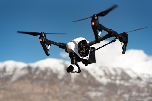
For most small-to-mid-size professional mapping work, the DJI Mavic 3 Enterprise is the best drone for land mapping. It balances portability, mapping-ready camera hardware, RTK support, and a relatively manageable learning curve better than most alternatives.
Here is the short version:
- Best overall for most buyers: DJI Mavic 3 Enterprise
- Best budget learning option: A consumer camera drone with waypoint support and confirmed mapping-app compatibility, such as a DJI Mini 4 Pro or Air 3-class drone
- Best for very large properties and long corridors: A fixed-wing or VTOL mapping platform such as the WingtraOne GEN II
- Best enterprise upgrade for higher-end survey teams: DJI Matrice 350 RTK with Zenmuse P1
- Most important buying rule: If the output will be used for legal boundaries, engineering sign-off, or regulated survey work, verify local surveying rules and required control methods before choosing any drone
Best Drone for Land Mapping by Budget at a Glance
| Budget band | Best fit | Best for | Main compromise |
|---|---|---|---|
| Under about $1,500 | Consumer camera drone | Learning photogrammetry, small-site maps, rough measurements, simple progress tracking | Rolling shutter, lighter wind performance, less robust mapping workflow |
| About $3,000 to $6,000 | DJI Mavic 3 Enterprise | Most commercial land mapping, stockpiles, construction progress, site models, topographic support | Less payload flexibility than larger enterprise systems |
| About $10,000 and up | Fixed-wing or VTOL mapping drone | Large acreage, agriculture, mining, forestry, corridor-style coverage | Higher training burden, launch/recovery planning, larger total system cost |
| About $15,000 and up | Matrice 350 RTK + Zenmuse P1 | Enterprise photogrammetry, tougher sites, heavier workflows, larger teams | Higher cost, more logistics, more gear to manage |
First, define what kind of land mapping you actually mean
A lot of bad drone purchases happen because “land mapping” sounds like one task when it is really four or five different jobs.
Small-site visual maps
This is the lightest use case. You want an orthomosaic, which is a stitched top-down map made from overlapping aerial photos, plus maybe a simple 3D model.
Typical examples:
- Construction progress updates
- Real estate development tracking
- Small farm or estate documentation
- Rough planning and site communication
A consumer drone can often do this well enough if you fly carefully and process the data properly.
Measurement and volume work
This is where buyers start needing better geotagging, more consistent image quality, and cleaner mission planning.
Typical examples:
- Stockpile volume calculation
- Earthworks monitoring
- Quarry progress
- Cut-and-fill comparisons
You can still do this with lower-cost platforms, but the risk of errors and rework goes up quickly if the camera and positioning system are not designed for mapping.
Survey-grade topo support
Now accuracy matters much more. This often means RTK or PPK, ground control, stronger workflows, and tighter quality checks.
Typical examples:
- Engineering support
- Site design inputs
- Topographic models
- Construction verification
This is where the Mavic 3 Enterprise starts to make much more sense than a standard camera drone.
Large-area mapping
Once the site gets big, flight efficiency becomes the issue. A multirotor may still work, but it can become slow, battery-hungry, and operationally clumsy.
Typical examples:
- Large farms
- Mining leases
- Forestry blocks
- Long corridors such as roads, canals, or utilities
This is where fixed-wing or VTOL mapping platforms earn their cost.
Legal boundary and cadastral work
This is the most misunderstood category. In many countries, boundary definition and official survey deliverables are regulated professional activities. A drone can be part of that workflow, but it does not automatically replace a licensed surveyor or local legal requirements.
If your client cares about ownership lines, title, cadastral filing, or signed survey outputs, verify the local rules before you buy.
The features that matter most for mapping
Marketing terms do not tell you much. These features do.
Mechanical shutter
A mechanical shutter exposes the image in a way that reduces motion distortion. That matters because mapping drones capture lots of overlapping photos while moving.
Why it matters:
- Straighter edges
- Better image alignment
- Less distortion in stitched maps
- More dependable outputs on repetitive flights
A rolling-shutter camera can still work for basic photogrammetry, especially if you fly slower and maintain good overlap. But if mapping is your business, a mechanical shutter is one of the clearest upgrade points.
RTK and PPK
RTK stands for Real-Time Kinematic. It improves the accuracy of the drone’s photo positions using correction data during flight. PPK does something similar after the flight in processing.
Why it matters:
- Better geotag accuracy
- Faster field workflow in many cases
- Less dependence on ground control for some jobs
- Better consistency across repeated surveys
What buyers get wrong: RTK does not magically make every map survey-grade. Many jobs still benefit from or require ground control points, independent checks, and professional survey practice.
Mission planning and waypoint control
For mapping, manual flying is rarely the best long-term workflow. You want repeatable grid missions, consistent overlap, controlled speed, and reliable camera triggering.
Look for:
- Automated grid flights
- Corridor mission support if you map roads or utilities
- Repeatable waypoint missions for progress tracking
- Software compatibility with the apps and controllers you plan to use
This is a huge buyer-regret area. Before you buy any drone, confirm that your preferred mission-planning and processing software supports that exact aircraft and controller combination.
Flight efficiency
A mapping drone is not just a camera in the sky. It is a production tool. A drone that covers too little ground per battery becomes expensive in labor and frustrating in the field.
Ask yourself:
- How much land do I need to cover in one session?
- How windy are my sites?
- How many batteries can I realistically manage?
- Will I be working alone or with a crew?
For small parcels, multirotors are usually easier. For big acreage, fixed-wing or VTOL becomes much more attractive.
Software and outputs
The drone is only half the system. The real deliverable comes from the processing workflow.
Common mapping outputs include:
- Orthomosaics
- DSMs and DTMs
- Point clouds
- Contours
- Volume calculations
- 3D meshes
Popular software ecosystems include Pix4D, DroneDeploy, Agisoft Metashape, DJI Terra, and WebODM. You do not need all of them, but you do need a workflow that fits your team, clients, and computer hardware.
Service, batteries, and repair support
This matters more than many buyers expect.
A brilliant drone with weak local repair coverage can become a terrible business purchase. Mapping projects often run on deadlines. If a gimbal, battery, arm, or controller fails, support turnaround affects revenue.
Before buying, check:
- Battery availability
- Propeller and accessory supply
- Local repair options
- Firmware stability history
- Replacement turnaround in your market
Best drones for land mapping by budget
Under about $1,500: consumer camera drones are for learning, not ideal long-term mapping businesses
If your budget is tight, a consumer drone can still be a smart first step. It can teach you flight discipline, photo overlap, processing, and how maps are actually built.
The best fit here is usually a consumer DJI drone with waypoint support and mapping-software compatibility, often in the Mini 4 Pro or Air 3 class.
This band makes sense for:
- New pilots learning photogrammetry
- Small private landowners
- Hobbyists testing mapping workflows
- Solo creators who need rough site maps, not regulated survey outputs
What it does well:
- Low entry cost
- Easy transport
- Simple setup
- Good enough for small-site orthomosaics and rough 3D models
What you give up:
- Mechanical shutter
- Stronger wind performance on lighter aircraft
- More robust enterprise workflow
- Better positional accuracy
- Better scaling for repeat commercial jobs
Bottom line: if you are only learning or mapping small areas with modest accuracy needs, this band is fine. If you plan to sell mapping services seriously, this is usually a stepping stone, not the final answer.
About $3,000 to $6,000: DJI Mavic 3 Enterprise is the best overall buy
For most readers asking “what is the best drone for land mapping,” this is the answer.
The DJI Mavic 3 Enterprise is the sweet spot because it combines the things that actually matter:
- Mapping-oriented camera workflow
- Mechanical shutter
- RTK support
- Good portability
- Easier field deployment than larger enterprise systems
- Lower training and logistics burden than fixed-wing platforms
It is a strong fit for:
- Construction companies
- Survey support teams
- Quarries and stockpile operators
- Solar, infrastructure, and land development firms
- Freelancers building a mapping business
Why it stands out:
- It is portable enough for solo operators.
- It is serious enough for paid mapping work.
- It reduces many of the compromises of consumer drones without pushing you into full enterprise complexity.
Who should buy it:
- Buyers who want one drone to handle most mapping jobs
- Teams mapping small to medium sites regularly
- Operators who want a practical upgrade path without jumping into a big aircraft system
Who should skip it:
- Buyers only experimenting on a tiny budget
- Teams mapping very large properties every day
- Enterprises needing heavier sensors, larger payload flexibility, or more advanced operational redundancy
If you can afford it and your jobs fit a multirotor workflow, the Mavic 3 Enterprise is usually the least regrettable mapping purchase.
About $10,000 and up: fixed-wing or VTOL mapping drones win on coverage
If your land mapping jobs are large, repetitive, and acreage-heavy, a fixed-wing or VTOL platform can save major time.
A real example in this class is the WingtraOne GEN II.
This type of platform is best for:
- Large farms and estates
- Mining and aggregates
- Forestry
- Utility corridors
- Broad-area topographic coverage
Why buyers choose it:
- Much greater area coverage per mission
- Better productivity on large sites
- Stronger business case where labor time matters more than aircraft price
Tradeoffs:
- More training
- More mission-planning discipline
- More takeoff and landing considerations
- Larger transport footprint
- Higher all-in system cost
If most of your jobs are under a few dozen hectares, fixed-wing is often overkill. If you routinely map hundreds of hectares or long corridors, it can be the right tool.
About $15,000 and up: Matrice 350 RTK with Zenmuse P1 for high-end enterprise work
The DJI Matrice 350 RTK paired with the Zenmuse P1 is not the first mapping drone most people should buy. But it is a serious answer for organizations with demanding projects and trained teams.
This setup makes sense for:
- Survey and engineering firms
- Larger enterprise departments
- Teams operating on complex, high-value sites
- Buyers who need more payload flexibility and a broader upgrade path
Why teams choose it:
- Stronger enterprise platform
- High-end photogrammetry capability
- Better fit for tougher workflows and more complex operations
- Easier growth path into broader enterprise payload ecosystems
Why many people should not start here:
- Higher cost
- More transport and setup burden
- More operator training needed
- Bigger penalty for underusing the system
If your jobs are complex and you already know why you need this class of drone, it can be an excellent investment. If you are still learning mapping fundamentals, it is probably too much aircraft too soon.
Do not budget only for the aircraft
This is where many buyers underestimate the real cost of mapping.
Your full system budget may also need:
- Extra batteries
- Charging solution
- RTK corrections or survey control workflow
- Ground control targets
- Rugged tablet or controller accessories
- Processing software
- Data storage and backup
- Carry cases and field kits
- Insurance where required
- Training time
The cheapest aircraft can become the most expensive choice if it causes extra field time, poor outputs, or repeat flights.
Which drone fits your skill level?
Beginner
If you are still learning photogrammetry, start with a consumer drone only if you understand its limits. Use it to learn:
- Overlap
- Flight speed
- Lighting consistency
- Ground control basics
- Processing workflow
If your budget allows, a beginner can still start on the Mavic 3 Enterprise and skip the consumer phase entirely.
Intermediate operator or freelancer
This is the Mavic 3 Enterprise zone. It is advanced enough to support real commercial work without forcing you into a full enterprise fleet model.
It is the best fit if you want:
- Better data quality
- Repeatable outputs
- More client confidence
- Faster field workflow
Advanced survey or enterprise team
Once your jobs are larger, more regulated, or accuracy-sensitive, choose between:
- Fixed-wing/VTOL for large-area efficiency
- Matrice 350 RTK + P1 for complex enterprise photogrammetry and higher-end team workflows
Your decision here is less about flying skill alone and more about operational maturity, processing capacity, QA habits, and support infrastructure.
Safety, legal, and compliance checks before you buy
Land mapping is not just a buying decision. It is an operational one.
Before committing to any platform, verify:
- Aviation rules: pilot requirements, airspace permissions, altitude limits, and whether commercial work needs additional authorization in your country
- Surveying rules: whether boundary, cadastral, or engineering-grade deliverables require a licensed survey professional
- Site permissions: private land access, industrial site approval, mine or utility permissions, and restricted-area rules
- Privacy and data handling: some sites or jurisdictions restrict aerial imaging or sensitive geospatial data
- Battery transport rules: especially if you travel internationally with lithium batteries
- Insurance expectations: clients and site operators may require proof of liability coverage even when law does not
Also remember that large sites can tempt operators to stretch beyond visual line of sight, beyond approved altitude, or beyond safe battery margins. The right drone is the one you can operate legally and consistently, not the one that only looks efficient on paper.
Common mistakes people make when buying a mapping drone
Buying for camera hype instead of mapping workflow
A drone can shoot beautiful video and still be a poor mapping tool. Mapping needs repeatability, image consistency, and software fit.
Assuming RTK solves everything
RTK is excellent, but it does not replace quality control, checkpoints, and professional survey practice on every job.
Ignoring software compatibility
This is one of the most expensive mistakes. Always confirm aircraft, controller, mobile device, mission-planning app, and processing software compatibility before purchase.
Underestimating site size
A multirotor that works fine on a 5-hectare site may become painfully slow on a 300-hectare site.
Treating drone maps as legal boundary proof
In many places, that crosses into regulated survey work. Verify local law.
Buying too light for windy environments
A lightweight drone can be convenient, but it may struggle on exposed agricultural, coastal, or elevated sites.
Forgetting vegetation limits
Standard camera-based photogrammetry does not reliably see the ground through dense tree cover. If your project needs bare-earth terrain under canopy, you may need LiDAR or conventional survey support.
FAQ
What is the best drone for land mapping overall?
For most buyers doing real commercial land mapping, the DJI Mavic 3 Enterprise is the best overall choice. It offers the strongest balance of portability, mapping-ready hardware, RTK capability, and manageable workflow complexity.
Can a cheap drone make accurate land maps?
Yes, for basic and relative mapping tasks. A lower-cost consumer drone can produce useful orthomosaics and 3D models for small sites, planning, and progress tracking. It is less ideal for demanding accuracy work, repeat commercial jobs, and high-wind environments.
Do I need RTK for land mapping?
Not always. For simple visual mapping and rough measurements, no. For higher-accuracy work, repeat surveys, and professional deliverables, RTK becomes much more valuable. Some jobs still require ground control and independent checks even with RTK.
Is fixed-wing better than multirotor for mapping?
Only if your sites are large enough to justify it. Fixed-wing or VTOL platforms are much more efficient on large acreage and corridors. Multirotors are usually easier, simpler, and better for tighter sites, smaller parcels, and teams that value quick deployment.
Can a drone be used for legal property boundary surveys?
Sometimes as part of the workflow, but not automatically. In many countries, legal boundary work is regulated and may require a licensed surveyor, specific control methods, and documented accuracy standards. Always verify local rules before offering boundary deliverables.
What software should I check before buying a mapping drone?
Check both sides of the workflow:
- Mission planning compatibility
- Photo processing compatibility
- Output formats your client needs
- Team collaboration and storage needs
- Computer hardware required for processing
Do this before you buy the aircraft, not after.
How many batteries do I need for mapping work?
Enough to complete the job without rushing or cutting overlap. The exact number depends on site size, wind, temperature, and aircraft class. For regular commercial work, plan for a realistic field kit, not just the single battery count that looks acceptable in a product listing.
What if I need terrain under trees or dense vegetation?
A standard RGB camera mapping drone may not be enough. Dense canopy often blocks the ground from view. If bare-earth terrain is critical, you may need LiDAR, ground survey methods, or a mixed workflow.
The decision that saves the most regret
If you want the simplest answer, buy the DJI Mavic 3 Enterprise for most professional land mapping work, buy a consumer drone only if you are learning or working on a very tight budget, and move to fixed-wing/VTOL or a Matrice 350 RTK plus P1 only when your site size or accuracy demands clearly justify it.
Before you buy, write down three things: your typical site size, the accuracy your clients actually need, and the software workflow you will use. That short list will tell you more than any marketing page ever will.