Choosing the best drone for surveyors is less about buying the most expensive aircraft and more about matching the platform to the work. Most expensive mistakes happen when buyers chase headline features like LiDAR, thermal, or extra camera modules before defining their deliverables, accuracy needs, and field workflow. If you want to avoid overspending or buying the wrong features, start with the survey job, not the drone brochure.
Quick Take
For most surveying teams, the safest first purchase is a mapping-focused multirotor with a reliable waypoint mission system, a mechanical or global shutter camera, and an RTK-capable workflow. That setup usually covers construction progress, stockpiles, topo updates, small-to-medium sites, and many corridor jobs without the cost and complexity of fixed-wing or LiDAR systems.
Here are the big buying rules:
- Buy for the deliverable, not the spec sheet.
- If mapping is the core job, camera quality for photogrammetry matters more than cinema features.
- RTK or PPK can improve workflow and reduce field friction, but it does not remove the need for checkpoints or quality control.
- Fixed-wing only starts to make sense when you regularly cover very large areas and have room to launch and recover safely.
- LiDAR is powerful, but many buyers overspend on it before they have enough vegetated, complex, or time-critical work to justify it.
- Software compatibility, battery logistics, repair support, and local compliance matter just as much as the aircraft itself.
If you are unsure, choose the platform that solves 80 percent of your work cleanly rather than the one that looks future-proof on paper.
Start with the survey output you actually need
The best drone for surveyors depends first on what you need to deliver. A drone used for site progress images is not the same buying decision as a drone used for stockpile volumes, surface models, corridor mapping, or vegetation-heavy terrain.
Before comparing aircraft, answer these five questions:
-
What are you delivering? – Orthomosaics – Surface models – Point clouds – Contours – Stockpile volumes – Corridor maps – Inspection-style reference imagery
-
What accuracy does the client expect? – Internal progress documentation – Measurement-grade output for planning or earthworks – Survey deliverables that must meet a stated standard
-
What kind of sites do you fly most often? – Tight construction sites – Quarries and mines – Agricultural land – Large open tracts – Roads, rail, pipelines, or utility corridors – Vegetated terrain
-
How often will you fly? – Occasional internal use – Weekly commercial jobs – Daily production use
-
What does your downstream workflow look like? – CAD – GIS – BIM – Progress reporting – Client web portals – In-house survey adjustment and QA
That exercise stops a lot of bad purchases. It also reveals something many buyers miss: some “survey drone” features are only valuable if they improve the full workflow, not just the flight.
For example:
- If you mainly map small construction sites, a compact mapping multirotor may be ideal.
- If you fly long corridors or large land parcels every week, fixed-wing or VTOL may save time.
- If you regularly work in dense vegetation and need ground elevation through canopy, LiDAR may be justified.
- If your work is boundary-related or legally sensitive, the drone may support the survey, but not replace conventional survey methods or licensed signoff.
That last point matters. In many places, drone data can support surveying, but only licensed professionals can certify certain deliverables. Always verify the local legal and professional requirements for survey work.
The right drone class for the job
The biggest buying mistake is choosing the wrong class of platform. Here is the simplest way to think about it.
| Drone class | Best for | Main strengths | Main limits | Typical regret risk |
|---|---|---|---|---|
| Compact mapping multirotor | Small-to-medium sites, construction, stockpiles, routine topo updates | Easy to transport, fast setup, lower training burden, good for tight sites | Less area covered per flight than fixed-wing, limited payload flexibility | Very low if most jobs are under moderate size |
| Enterprise multirotor | Professional mapping, repeat work, tougher field conditions, advanced payload options | Better workflow control, stronger battery ecosystem, more robust missions, often better support | Heavier, costlier, still less efficient than fixed-wing on huge areas | Low if you need dependable production work |
| Fixed-wing or VTOL mapping drone | Large sites, large tracts, long corridors, area-efficiency | Covers more area per flight, efficient for big jobs | More launch/recovery considerations, more training, less ideal in tight or cluttered areas | High if your jobs are mostly small sites |
| LiDAR-capable heavy-lift platform | Vegetated terrain, complex elevation, specialty survey work | Can capture terrain where photogrammetry struggles, strong for specialist jobs | High cost, heavier workflow, more processing and QA burden | Very high if your work does not truly require LiDAR |
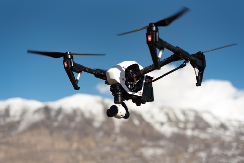
For most buyers entering drone surveying, a multirotor is the right first platform. It is more forgiving, easier to deploy in confined sites, and simpler for teams moving from traditional survey workflows into drone data capture.
Fixed-wing becomes attractive when area coverage dominates the economics. If you spend more time swapping batteries than flying useful acreage, or your team regularly maps long corridors and large parcels, it is worth evaluating. But many teams buy fixed-wing too early, then realize their sites are too tight, too irregular, or too operationally messy for it to be their daily tool.
Which features actually matter and which ones cause overspending
A good buying guide for surveyors should separate must-have features from expensive distractions. Not every premium feature improves survey outcomes.
Mechanical or global shutter
If photogrammetry is the main job, this is one of the most important items on your checklist.
A mechanical or global shutter reduces image distortion caused by aircraft movement while the image is being captured. That helps produce more reliable mapping results, especially on repeat commercial jobs.
A rolling shutter camera can still work for some projects, especially on slower, carefully planned flights, but it is more likely to create frustration if mapping is your main revenue source.
If you are buying specifically for surveying, prioritize a platform designed for mapping rather than one built mainly for cinematic video.
RTK and PPK
RTK stands for real-time kinematic correction. PPK stands for post-processed kinematic correction. Both aim to improve the positional quality of image geotags by using correction data from a base station or network service.
This matters because better geotagging can reduce field time, improve workflow consistency, and in some cases reduce reliance on large numbers of ground control points.
But do not overstate it:
- RTK is not magic.
- PPK is not a substitute for good flight planning.
- Neither removes the need for checkpoints and validation if accuracy matters.
- Client specs and local survey standards still govern the final deliverable.
For many professional survey teams, RTK capability is worth paying for. For occasional internal site mapping, it may be less critical.
Camera resolution and sensor quality
Survey buyers often over-focus on megapixels.
Yes, resolution matters. But for mapping, the full camera system matters more:
- shutter type
- lens consistency
- calibration quality
- image sharpness across the frame
- reliable geotagging
- repeatable mission capture
A bigger sensor is not automatically better for surveying. It may help in some lighting conditions, but mapping is usually done in controlled daylight windows, with overlap and motion planning doing much of the heavy lifting.
If you mainly need accurate photogrammetry, choose the camera that is proven for mapping workflow, not the one that sounds best in a general camera ad.
Flight time and coverage efficiency
Battery endurance matters, but not in isolation.
What really matters is how much usable ground you can capture per day with acceptable quality. That depends on:
- flight time
- cruise efficiency
- battery swap time
- charging setup
- mission planning speed
- wind tolerance
- terrain following performance
- number of batteries in your kit
A drone with modest flight time but quick field workflow can outperform a theoretically longer-endurance drone that is harder to deploy and maintain.
Wind tolerance and operational stability
Surveyors often work in exposed sites, open terrain, quarries, mines, and partially developed land. A drone that handles wind predictably can protect both productivity and data quality.
This is easy to overlook in the buying phase. Stable, repeatable image capture often matters more than flashy extra features.
Terrain following and repeatable waypoint missions
For sloped land, quarries, or sites with major elevation change, terrain-aware mission planning can make a real difference. It helps maintain more consistent ground sampling and overlap.
Repeatable waypoint missions also matter for progress surveys, where consistency between flights is valuable.
These features are not just convenience items. In production work, they protect quality and save time.
Obstacle sensing
Obstacle sensing is helpful, but surveyors should not mistake it for a core mapping feature. It is most valuable when working around structures, cranes, partial buildouts, or complex site edges.
If your work is almost always in open terrain, obstacle sensing is useful but not a reason to overspend heavily on its own.
Payload flexibility
Interchangeable payloads sound future-proof, and sometimes they are. But they can also be an expensive trap.
Only pay for payload flexibility if you have a realistic path to using it. If your next two years of work are standard photogrammetry, a simple mapping platform may give you better ROI than a heavier aircraft designed to carry multiple specialist sensors.
Weather resistance and field toughness
Survey work is commercial work. A fragile consumer-style kit can look affordable until it causes delays, repair headaches, or missed jobs.
Look closely at:
- field durability
- dust and light moisture resistance
- controller reliability
- charger quality
- battery handling
- propeller availability
- service turnaround
- local dealer or distributor support
These are not glamorous features, but they directly affect profit.
A simple feature filter to avoid buying the wrong extras
| Feature | Buy it if | Skip it if | Why buyers regret it |
|---|---|---|---|
| RTK or PPK workflow | You deliver professional mapping and want cleaner geotagging and better field efficiency | You only need occasional visual site maps or internal reference imagery | Buyers either overspend on RTK they never validate, or skip it and later wish they had it |
| Mechanical or global shutter | Mapping is the main job | Video is the main job and surveying is rare | Many buyers start with a cinema-focused drone and outgrow it fast |
| Thermal camera | You also sell inspections, heat-loss surveys, or search applications | You only do standard mapping and topo work | Thermal adds cost but often no value for survey deliverables |
| Multispectral camera | You have crop-health or vegetation analytics demand | Your work is construction, mining, stockpiles, or topo | Multispectral sounds advanced but is niche for many survey teams |
| LiDAR | You regularly map vegetated terrain or complex elevation where photogrammetry struggles | Most jobs are bare earth, construction, open mine, or stockpile work | LiDAR is powerful but easy to overbuy |
| Interchangeable payloads | You already know new sensor types are part of your business plan | You want a first survey drone for standard mapping | Flexibility costs money and often adds complexity before it adds revenue |
The budget is bigger than the aircraft
Survey drone buyers often compare only aircraft prices. That is how overspending happens.
The real cost sits in the full operating system around the drone:
- aircraft and controller
- batteries
- multi-battery charging
- spare props and consumables
- RTK module or correction workflow
- base station or network correction access where needed
- ground control targets
- survey-grade GNSS rover access, owned or subcontracted
- mapping software
- cloud processing or local workstation capacity
- rugged transport cases
- pilot training
- quality assurance workflow
- insurance, permits, and compliance overhead where required
- downtime during repairs
A cheaper drone can become expensive if it slows down the field crew, produces unstable data, or has weak repair support. A pricier drone can still be the better buy if it saves repeat visits, reprocessing, and production delays.
If you are trying to control spend, prioritize your budget in this order:
- Reliable mapping workflow
- Correct camera and geotagging capability
- Enough batteries for practical field days
- Software fit with your existing deliverables
- Repair and support confidence
- Nice-to-have extras
That order prevents a lot of regret.
What a good first survey drone usually looks like
For many surveyors, the best first purchase is not the most advanced system on the market. It is usually a platform with these traits:
- purpose-built mapping capability
- mechanical or global shutter
- RTK-capable workflow
- strong waypoint mission planning
- enough battery support for half-day or full-day field use
- easy transport and deployment
- dependable software exports into CAD or GIS workflows
- repair support you can actually access
That kind of setup usually beats both extremes:
- a consumer camera drone that is not really built for survey production
- a heavy specialist platform bought far ahead of real business demand
If your work later expands into large corridors, dense vegetation, or advanced enterprise capture, you can then add fixed-wing, VTOL, or LiDAR with a much clearer business case.
Safety, legal, and compliance checks before you buy
A drone that looks perfect on paper can become a bad purchase if it does not fit your regulatory reality.
Before committing, verify:
Aviation compliance
Check the rules in every country or region where you expect to work, including:
- operator registration
- pilot qualification or certification
- airspace authorization
- altitude limits
- visual line of sight requirements
- remote identification or electronic ID requirements where applicable
- rules for flight near people, roads, infrastructure, or controlled airspace
- rules for night or low-visibility operations if relevant
Site permissions
Survey teams often work on client-owned or controlled land, but that does not remove the need to confirm local airspace and site permission conditions.
Survey and professional practice rules
In some jurisdictions, only licensed surveyors can certify certain mapping outputs, boundary products, or regulated survey deliverables. Drone data collection may be allowed, but signoff may still be restricted.
Data and privacy controls
If your workflow captures neighboring properties, sensitive infrastructure, or personal data, check the privacy and data-handling obligations that apply where you operate.
Cross-border operations and battery transport
If you travel for projects, verify airline battery policies, customs treatment, and local drone import or use restrictions before you fly. These vary widely.
The practical lesson: do not buy a system just because it is technically capable. Buy one you can legally and consistently operate where your work happens.
Common mistakes survey drone buyers make
Buying a camera drone instead of a survey workflow
A great-looking drone is not always a great survey tool. Buyers often choose the aircraft that shoots beautiful video, then realize it is missing the camera behavior, geotagging quality, or mission reliability needed for production mapping.
Assuming RTK eliminates ground control and QA
RTK improves workflow. It does not eliminate verification. If you skip checkpoints and quality control, you are trusting assumptions instead of measured results.
Overbuying LiDAR
LiDAR is often the dream purchase. It is also one of the fastest ways to tie up capital in a system that sits underused. If most of your work is bare-earth construction or stockpile mapping, photogrammetry may deliver better ROI.
Ignoring software exports
A drone is only useful if the output fits your downstream workflow. Check the formats your clients or internal teams actually need.
Underestimating battery and charging needs
A drone with only a minimal battery kit can turn a field day into stop-start frustration. Survey crews lose money when the aircraft becomes the bottleneck.
Choosing fixed-wing too early
Fixed-wing is excellent for the right job. It is not excellent for every job. Tight sites, complex site boundaries, and awkward recovery areas can make it the wrong daily tool.
Treating the drone as a full replacement for survey instruments
A drone is a powerful capture platform, not a universal replacement for total stations, GNSS rovers, checkpoints, control, or professional judgment.
A practical 7-step buying checklist
If you need to make a real purchase decision, use this sequence.
-
List your top three deliverables. – Be specific about what clients receive.
-
Define your typical site size and terrain. – Small sites, corridors, open land, vegetation, stockpiles, steep surfaces.
-
Write down the accuracy and verification standard you must meet. – Include checkpoint expectations and internal QA.
-
Choose the drone class first. – Multirotor, fixed-wing, or LiDAR platform.
-
Filter features ruthlessly. – Keep only the features that improve your actual workflow.
-
Price the full first-year operating kit. – Include software, batteries, support, and downtime risk.
-
Ask for a live demo or sample deliverable. – The best pre-purchase test is seeing output from a job like yours.
That process is far more reliable than comparing marketing specs line by line.
FAQ
Do all surveyors need RTK or PPK?
No. But many professional surveyors benefit from it. If you regularly create mapping deliverables where positional reliability matters, RTK or PPK usually improves workflow. If you only need occasional visual documentation, it may not be essential.
Is a consumer drone good enough for survey work?
Sometimes for simple internal reference maps or low-risk visual tasks. But if surveying is a real business workflow, many teams quickly outgrow consumer drones because of shutter type, mission planning limits, repair concerns, and data consistency issues.
What is better for surveying: multirotor or fixed-wing?
For most buyers, multirotor is the better starting point. It is easier to deploy and works well on small-to-medium sites. Fixed-wing becomes more attractive when you routinely cover large areas or long corridors and have the field conditions to operate it efficiently.
Do I need LiDAR, or is photogrammetry enough?
Photogrammetry is enough for many survey jobs, especially on open ground, construction sites, quarries, and stockpiles. LiDAR becomes more compelling when vegetation, complex terrain, or high-volume specialist work makes photogrammetry inefficient or unreliable.
Can a drone replace a total station or GNSS rover?
No, not universally. A drone complements conventional survey tools. You may still need ground control, checkpoints, detail capture, and instrument-based verification depending on the project and the standard you must meet.
How many batteries should a survey team buy?
Enough to keep the crew productive, not just the drone airborne. The right number depends on travel time, site size, charging setup, and turnaround speed. For commercial use, a minimal battery kit often becomes a false economy.
What software compatibility should I check before buying?
Check that your workflow can reliably produce the outputs your team or clients use, such as orthomosaics, point clouds, surface models, contours, CAD-friendly files, and GIS-ready formats. Also check processing time, data storage demands, and collaboration features.
How accurate can a survey drone be?
That depends on camera quality, shutter behavior, flight altitude, overlap, ground control, correction workflow, wind, terrain, surface texture, and processing quality. Final accuracy should be verified against independent checkpoints and the client’s required standard, not assumed from the drone’s marketing material.
The smartest buying move
If you want the best drone for surveyors without overspending, buy the platform that fits your current workload best, not the one that promises every possible future workflow. For most teams, that means a mapping-first multirotor with a proper survey camera, RTK-capable workflow, dependable software, and strong battery and support coverage. If your job mix later proves you need fixed-wing efficiency or LiDAR capability, upgrade with evidence, not ambition.