If you are stuck on RTK drones or standard GPS drones, the smartest choice usually has less to do with headline specs and more to do with what you actually need your drone to produce. Most pilots need reliable flight, good imaging, simple workflow, and easy travel. RTK matters when positional accuracy, repeatability, and map-quality data are central to the job.
Quick Take
Here is the short version:
- Buy a standard GPS drone if you mainly shoot photos, video, travel content, real estate, social media, casual inspections, or recreational flights.
- Buy an RTK drone if you need accurate maps, repeatable site documentation, stockpile measurement, construction progress tracking, infrastructure workflows, or location data that clients will act on.
- Do not buy RTK just because it sounds more “pro.” RTK improves positioning and geotag accuracy. It does not automatically improve your camera, storytelling, editing, or flying judgment.
- If you are moving toward paid mapping work, RTK can save time and reduce rework, especially when you run planned missions repeatedly.
- If you are unsure, a standard GPS drone with a strong camera and broad accessory ecosystem is usually the lower-regret purchase.
The core difference in plain English
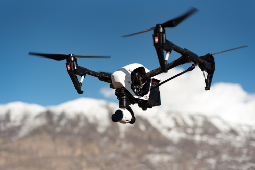
A standard drone uses satellite positioning, often across multiple systems like GPS, Galileo, GLONASS, or BeiDou. Most buyers still call this “GPS,” even when the drone is actually using several global navigation satellite systems. For everyday flying, that is usually enough.
An RTK drone adds a correction layer. RTK stands for real-time kinematic. It uses correction data from a nearby base station or a network service to refine the drone’s position while it flies. The goal is much more accurate location data for the aircraft and the images it captures.
That matters most when the drone is not just making pictures, but producing measurable outputs such as:
- Orthomosaics, which are stitched overhead maps corrected for distortion
- 3D models
- Elevation products
- Volume measurements
- Repeatable construction or infrastructure records
- GIS and CAD-ready site data
For simple flying and filming, standard GPS is often enough. For location-sensitive work, RTK can be the difference between “good enough visually” and “good enough to trust operationally.”
Standard GPS vs RTK at a glance
| Decision area | Standard GPS drone | RTK drone |
|---|---|---|
| Best for | Travel, content, hobby, real estate, general photography, simple visual inspections | Mapping, surveying support, construction tracking, stockpiles, repeat inspections, enterprise workflows |
| Position accuracy | Usually meter-level rather than precision-grade | Can reach centimeter-level positioning when workflow, corrections, and processing are done properly |
| Setup complexity | Simple and fast | Higher; may require correction service, base station, mission planning, and data QA |
| Workflow burden | Low | Medium to high |
| Extra costs | Mostly batteries, filters, storage, repair | Often adds software, training, correction services, support, and validation steps |
| Biggest value | Better flying experience and image capture for most users | Better geospatial accuracy and repeatability |
| Biggest risk | Outgrowing it for mapping-heavy work | Overpaying for capability you rarely use |
What RTK actually changes, and what it does not
This is where many buyers get misled.
RTK changes your location data
RTK mainly improves:
- The precision of image geotags
- Repeatability of automated flight paths
- Alignment confidence across repeated missions
- Mapping efficiency
- Measurement confidence when the workflow is built correctly
In practical terms, that can mean:
- Less field time fixing errors later
- Cleaner progress comparisons from month to month
- More dependable outputs for volume calculations
- Better consistency across teams and projects
RTK does not automatically make your drone “better” at everything
RTK does not guarantee:
- Better image quality
- Better low-light performance
- Better subject tracking
- Better obstacle avoidance
- Better cinematic motion
- Better flight decisions in wind, crowds, or complex terrain
If two drones cost the same and one has RTK while the other has a much better camera, many creators, travelers, and photographers will get more value from the better camera.
RTK also does not eliminate workflow discipline
Even with RTK, accuracy still depends on things like:
- Good mission planning
- Proper overlap in mapping flights
- Strong sky visibility
- Reliable corrections
- Sensible altitude choices
- Quality processing software
- Checkpoints or validation where required
And for some professional deliverables, ground control points or at least independent checkpoints may still be expected. RTK reduces field burden in many jobs, but it does not remove the need for quality control.
When a standard GPS drone is the smarter path
For most individual buyers, standard GPS is the smarter first drone.
It fits how most people actually fly
A standard GPS drone is usually the right choice if your flights are mainly about:
- Capturing scenic travel footage
- Shooting social content or YouTube b-roll
- Real estate marketing
- Family trips and outdoor adventures
- Casual roof, farm, or property checks
- Learning aerial photography
- Low-friction flying with minimal setup
In those use cases, the finished result is a photo, video, or visual impression, not a geospatial deliverable. You usually do not need centimeter-level positioning to get a better sunset shot or a cleaner orbit around a cabin.
It lowers cost and complexity
Standard GPS drones typically mean:
- Faster deployment
- Fewer subscriptions or accessories
- Easier packing and travel
- Lower training burden
- Simpler troubleshooting
- Less risk of buying enterprise features you never use
That matters more than many buyers admit. A drone you actually carry, charge, and fly often is more valuable than a technically superior one that feels cumbersome.
It usually gives creators a better budget fit
If your budget has limits, it is often smarter to prioritize:
- Camera quality
- Battery life
- Portability
- ND filters and storage
- Spare batteries
- Repair support
- Editing and workflow tools
Those upgrades usually have a bigger effect on creative output than RTK.
Who will regret buying RTK too early?
You are likely to regret an RTK-first purchase if:
- You rarely run automated missions
- You mainly post to social platforms
- You do not process maps or models
- You do not have clients asking for accuracy
- You want the easiest possible travel setup
- You are still learning basic flight discipline
When RTK is the smarter path
RTK becomes the smart buy when the drone is part of a measurement or documentation system, not just a camera in the sky.
RTK makes sense for mapping and repeatable site work
RTK is a strong fit if you do any of the following regularly:
- Construction progress documentation
- Earthwork and stockpile volume monitoring
- Site mapping for planning teams
- Utility or corridor inspection with repeat flights
- Mine, quarry, or landfill measurement
- Agricultural field mapping
- Large property or infrastructure records
- GIS, BIM, CAD, or digital twin workflows
In these cases, the value of RTK is not abstract precision. It is operational efficiency and confidence.
RTK pays off when data quality affects decisions
If a client is using your outputs to:
- Compare changes over time
- Measure volumes
- Track subcontractor progress
- Plan drainage or grading work
- Monitor material movement
- Coordinate field teams
- Validate asset conditions
then positional accuracy stops being a nice bonus and starts becoming part of the service.
RTK can reduce field friction in commercial workflows
A good RTK setup can help by:
- Reducing reliance on large numbers of ground control points in some jobs
- Improving repeat mission consistency
- Shortening the gap between flight and usable output
- Making team workflows more standardized
- Reducing “why doesn’t this line up with last month?” headaches
That said, the more serious the project, the more you should define deliverable standards in advance. If the work supports engineering, legal boundary, or formal survey outcomes, verify local professional rules and client requirements before promising accuracy levels.
RTK is not the same as “enterprise success”
A common buying mistake is assuming RTK is the feature that separates serious operators from casual ones. In reality, plenty of profitable drone businesses do excellent work with standard GPS drones because the client is buying imagery, not coordinates.
Here is the better question:
What does your customer care about most?
If the customer pays for:
- polished video
- fast turnaround
- attractive listing photos
- compelling social content
- visual inspection evidence
- lightweight travel documentation
then RTK is often secondary.
If the customer pays for:
- measurable maps
- repeat site comparison
- volume estimates
- location accuracy
- aligned datasets over time
- geospatial integration
then RTK moves much closer to essential.
A practical 7-question decision framework
If you are buying soon, work through these in order.
1. What is the output you actually need?
Choose standard GPS if the output is mostly visual.
Choose RTK if the output must be measurable, repeatable, or location-critical.
This one question eliminates most confusion.
2. How often will you run planned missions?
If you mostly fly manually, frame shots, or improvise around scenes, RTK is less important.
If you repeatedly fly the same site, same route, or same grid, RTK gets more valuable quickly.
3. Are you solving a flying problem or a data problem?
Many buyers think they have a flying problem when they really have a data problem, and vice versa.
- Need better shots, easier travel, or smoother content workflow? Standard GPS is usually enough.
- Need better positional confidence and map alignment? RTK is the right tool.
4. Can you support the full RTK workflow?
RTK is not just a drone feature. It is a system.
You may need to manage:
- A correction source, such as a base station or network RTK service
- Mission planning software
- Data processing software
- Quality checks and checkpoints
- Staff training
- Data storage and file management
If you are not prepared for that, RTK may sit underused.
5. Will your environment support reliable corrections?
RTK works best when the positioning environment is cooperative. Problems can appear around:
- Dense urban canyons
- Heavy tree cover
- Bridges and steel structures
- Poor data coverage for network corrections
- Remote areas without correction infrastructure
If you often work in those conditions, you need to think beyond the marketing brochure. In some operations, post-processed workflows such as PPK, or a more controlled field process, may be more realistic.
6. Will your clients pay for the difference?
Some buyers chase RTK because they want to “future-proof” their purchase. That can be reasonable, but only if future demand is likely.
Ask:
- Do clients already ask for maps, measurements, or repeat reports?
- Are you losing jobs because you lack positional accuracy?
- Will RTK save enough time to justify the extra burden?
- Can your team turn better positioning into billable value?
If not, standard GPS may be the better financial choice.
7. What is your upgrade path if your work changes?
This is the most useful question for many growing operators.
If you are a creator now but may add mapping later, consider one of these paths:
- Buy a strong standard GPS drone now and rent RTK when needed.
- Buy into a platform ecosystem that has enterprise support or optional RTK add-ons.
- Buy RTK now only if paid geospatial work is already on the near-term roadmap.
Buyer profile guide: which path fits which pilot?
Standard GPS usually fits best for:
- New hobbyists
- Travel creators
- Aerial photographers
- Real estate marketers
- Event and tourism shooters
- Small business owners who need visual site checks
- FPV pilots adding a camera drone to their kit
- Buyers who care most about portability and speed
RTK usually fits best for:
- Mapping providers
- Survey-adjacent teams
- Construction firms
- Mining and aggregates operators
- Utilities and infrastructure teams
- Asset management departments
- Public works and land management workflows
- Companies standardizing repeatable drone data collection
Hidden costs buyers forget
The drone body is only part of the purchase decision.
Standard GPS hidden costs
These are familiar and manageable:
- Extra batteries
- Chargers and storage
- ND filters
- Case or bag
- Propellers
- Memory cards
- Repair or refresh plans
RTK hidden costs
These are where the real jump happens:
- Correction services or base station gear
- Mapping mission software
- Processing software
- Team training
- Quality assurance steps
- More rigid operational procedures
- Enterprise support expectations
- Additional storage and data management
None of that makes RTK a bad choice. It just means the real decision is not “Do I want more accuracy?” It is “Do I need the whole precision workflow?”
Safety, legal, and compliance limits to know
RTK changes data quality, not the legal status of your flight.
Before operating commercially or in sensitive areas, verify the rules that apply in your location. Depending on the country or region, that can include:
- Drone registration
- Pilot certification or competency requirements
- Airspace authorization
- Remote identification requirements
- Privacy and data protection rules
- Restrictions around infrastructure, ports, rail, utilities, or government sites
- Permission from landowners, site managers, or clients
Also remember:
- An RTK drone does not give you permission to fly where a standard drone cannot.
- Mapping a site may trigger extra sensitivity around privacy, security, or data ownership.
- In some places, legal boundary or cadastral survey work may be restricted to licensed professionals.
- If you travel internationally, verify battery transport rules, import issues, and whether your correction method will work in the destination country.
If a client wants measurements that affect contracts, quantities, design, or compliance, define scope and accuracy expectations before flying.
What people get wrong about RTK
“RTK means better footage”
Usually false. RTK improves positional accuracy, not image aesthetics.
“RTK means survey-grade by default”
False. Final accuracy depends on the full workflow, not just the badge on the aircraft.
“I can skip checkpoints forever”
Risky assumption. For some jobs, independent validation is still smart or required.
“If I buy RTK, I’m future-proof”
Only if your business will actually use it. Otherwise you may be freezing budget that should have gone into batteries, lenses, training, or software.
“Standard GPS is only for beginners”
Also false. Plenty of experienced professionals use standard GPS drones every day because their clients buy visuals, not coordinates.
“RTK will make tough environments easy”
Not necessarily. Dense canopy, reflective surfaces, poor coverage, and complex sites can still create problems.
Three smart buying paths if you are still undecided
1. The creator-first path
Buy a standard GPS drone with the best camera and portability you can reasonably support.
Best for: – Travel creators – Photographers – Real estate shooters – Small social content teams – Recreational pilots
Why it works: – Lower cost – Faster learning curve – Better day-to-day value – Less workflow drag
2. The bridge path
Buy a platform or brand ecosystem that gives you room to step into mapping later.
Best for: – Solo operators adding services – Agencies testing drone services – Teams exploring construction or site work
Why it works: – Lower upfront complexity – Clearer upgrade path – Less risk of overbuying
3. The precision-first path
Buy RTK only when you already have a real mapping or measurement use case.
Best for: – Construction and engineering teams – Geospatial service providers – Operators with recurring repeat-site work – Asset and infrastructure programs
Why it works: – ROI is easier to justify – Training has a purpose – Accuracy becomes billable, not theoretical
FAQ
Is RTK worth it for photography and video?
Usually no, unless your photo or video workflow also depends on repeatable geospatial data. For pure visual storytelling, camera quality, portability, and flight convenience matter more.
Can a standard GPS drone still do mapping?
Yes, for some internal, visual, or lower-accuracy mapping jobs. It may be enough for rough context maps or basic site overviews. RTK becomes more valuable when positional accuracy, repeatability, and measurement confidence matter.
Does RTK replace ground control points?
Not always. RTK can reduce dependence on them in many workflows, but checkpoints or control may still be necessary depending on deliverable standards, site conditions, client expectations, and local professional rules.
Do I need internet for RTK?
Not always. Some RTK workflows use a local base station instead of a network service. Network-based corrections often require data coverage. What works best depends on your operating environment and setup.
Are RTK drones harder to fly?
The aircraft may not feel dramatically harder to pilot, but the workflow is more demanding. You need to manage corrections, mission planning, processing, and quality control more carefully.
Does RTK improve return-to-home or obstacle avoidance?
It may improve positioning precision in some contexts, but it is not a substitute for obstacle sensing, safe flight planning, or good pilot judgment. It should not be treated as a safety shortcut.
Can I travel with an RTK drone internationally?
Possibly, but you should verify aviation rules, battery transport limits, import or customs issues, data restrictions, and whether your correction workflow will function in the destination country. Do not assume your home setup translates cleanly abroad.
Is PPK a good alternative to RTK?
In some operations, yes. PPK, or post-processed kinematic, applies correction after the flight rather than during it. It can be useful where live correction links are unreliable. Whether it fits depends on your software, processing workflow, and delivery timeline.
The smartest path: buy for the output, not the spec sheet
If your drone’s job is to make compelling images, a standard GPS drone is usually the smarter, cheaper, lower-regret choice. If your drone’s job is to produce trusted location data, repeatable site records, or map-based deliverables, RTK is worth serious consideration.
Pick the drone path that matches what you will actually fly next month, not the version of your business you might become someday.