The Quantum Systems Trinity F90+ is a commercial VTOL fixed-wing drone aimed at mapping and survey work rather than consumer photography or casual flying. It is relevant to buyers who need runway-free deployment with the broader area efficiency that fixed-wing aircraft can offer in outdoor geospatial missions. Based on the supplied data, it remains an active model from Germany-based manufacturer Quantum-Systems.
Quick Summary Box
- Drone Name: Quantum Systems Trinity F90+
- Brand: Quantum Systems
- Model: Trinity F90+
- Category: mapping/survey
- Best For: Enterprise mapping, surveying, and geospatial field teams that want VTOL takeoff and landing
- Price Range: Not publicly confirmed in supplied data
- Launch Year: Not publicly confirmed in supplied data
- Availability: Not publicly confirmed in supplied data
- Current Status: Active
- Overall Rating: Not rated due to limited confirmed data
- Our Verdict: A niche professional VTOL fixed-wing platform for commercial mapping workflows, with strong conceptual appeal for survey teams but several key configuration and cost details still needing buyer verification
Introduction
The Trinity F90+ sits in the professional mapping/survey segment, where airframe efficiency, deployment flexibility, and data workflow matter more than consumer-style camera features. Quantum-Systems positions itself as a serious enterprise drone manufacturer, and the Trinity F90+ fits that profile as a commercial mapping VTOL.
For readers comparing survey platforms, this model matters because VTOL fixed-wing drones can bridge two important needs at once: vertical launch and recovery from constrained sites, plus more efficient forward flight than a typical multirotor. That combination can be especially attractive for construction, infrastructure, land surveying, environmental monitoring, and large-area mapping operations where crews may need to work from uneven ground, roadside pull-offs, or temporary project sites.
This is also a category where the buying process looks very different from shopping for a camera drone. A survey aircraft is rarely judged by how smooth its cinematic video looks or how easy it is to fly in a park. Instead, it is judged on practical business questions: How much area can it cover? How quickly can a field crew deploy it? What payloads are supported? How dependable is the mission-planning workflow? What sort of service, repair, and training ecosystem exists behind the aircraft? Those are the questions that make the Trinity F90+ worth discussing.
Another reason the Trinity F90+ is notable is that the VTOL fixed-wing class continues to occupy a useful middle ground in commercial UAV operations. Multirotors are often easier to understand and ideal for hovering, close inspection, and small sites, but they can become less efficient as the survey area grows. Traditional fixed-wing platforms can excel on wide-area capture, yet they may demand launch or recovery methods that complicate work in restricted environments. A VTOL fixed-wing aircraft is designed to reduce that compromise.
Based on the supplied data, however, this article should be read as a market-positioning and procurement-oriented assessment rather than a full spec-sheet review. The Trinity F90+ looks potentially compelling in concept, but buyers still need to verify many important details directly with Quantum Systems or an authorized dealer before making any procurement decision.
Overview
What kind of drone is it?
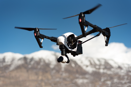
The Trinity F90+ is a VTOL fixed-wing drone in the mapping/survey category. In plain terms, that means it is designed to take off and land vertically like a multirotor, then fly its mission like a fixed-wing aircraft for better area coverage efficiency.
That description is more important than it may first appear. In the commercial drone market, “drone” can mean very different things depending on the job. A small quadcopter for roof inspections, a cinema drone for content production, and a fixed-wing survey aircraft may all be unmanned aircraft, but they serve very different operational needs. The Trinity F90+ belongs firmly in the geospatial camp, where predictable flight paths, repeatable data capture, and field productivity matter more than creative flying.
Because it is a VTOL fixed-wing design, operators should think of it as a mission aircraft rather than a flexible all-purpose platform. It is likely best suited to predefined routes, planned area capture, corridor missions, and repeatable survey blocks. It is not the sort of aircraft most people would buy for recreational flying, dynamic manual filming, or casual learning.
Who should buy it?
The most likely buyers are:
- Survey firms
- GIS and geospatial teams
- Engineering and construction companies
- Utilities and corridor-mapping operators
- Enterprise drone programs evaluating fixed-wing efficiency without runway requirements
It is not positioned as a hobby, FPV, or general creator drone.
To put that more concretely, the Trinity F90+ makes the most sense for organizations that treat drones as production tools. A surveying company might use it to generate orthomosaics or topographic data. A utility operator might use it to document linear infrastructure. An engineering team might use it to monitor site development over time. A government or land-management department might deploy it for regional documentation, environmental observation, or project planning.
For these kinds of users, the aircraft is only one part of the system. Field workflow, GNSS quality, data processing compatibility, training, compliance, and support all become part of the buying equation. That is why the Trinity F90+ should be evaluated in the context of a broader operational stack, not just as a standalone airframe.
What makes it different?
Its main differentiator is the VTOL fixed-wing layout. Compared with a pure multirotor, that format is generally better suited to covering larger outdoor areas efficiently. Compared with conventional hand-launch or catapult-launched fixed-wing mappers, VTOL can reduce launch and recovery friction in the field.
That field convenience can have real operational value. Survey crews do not always get ideal terrain. Launching from soft ground, rocky edges, roadside shoulders, or active project areas can be awkward with conventional fixed-wing systems. Vertical takeoff and landing can simplify site access, reduce dependency on specialized launch equipment, and make recovery gentler than belly-land landings in rough terrain.
The aircraft’s differentiation is therefore not about novelty for its own sake. It is about solving a practical deployment problem while retaining the broader coverage advantages associated with wing-borne flight. For the right mission profile, that is a meaningful distinction.
Key Features
- VTOL fixed-wing airframe for vertical takeoff and landing without a runway
- Commercial mapping focus rather than consumer imaging or recreational flying
- German manufacturer with enterprise positioning
- Active model status in the supplied data
- Likely designed for outdoor geospatial workflows such as site mapping, corridor missions, and survey capture
- Likely offers the deployment convenience of VTOL with the coverage efficiency of wing-borne cruise
- Better conceptual fit for professional data collection than for casual photo/video work
- Buyers should verify the exact sensor options, autonomy stack, navigation features, and software workflow, as those are not publicly confirmed in the supplied data
Those points summarize the platform at a high level, but each one matters in practical terms.
The VTOL fixed-wing design is the headline feature because it directly affects field operations. If your team routinely works from sites without open launch areas, this can reduce setup headaches and shorten mission preparation time. The mapping-first focus matters because it suggests the product was built around geospatial use rather than adapted from a consumer camera platform. The enterprise positioning matters because support, procurement, documentation, and service pathways often look different in the enterprise market than in retail drone sales.
The active status is also relevant. In enterprise procurement, buyers usually want to avoid aircraft that are clearly outdated, unsupported, or near the end of their lifecycle. “Active” does not automatically guarantee good support or future roadmap strength, but it does at least indicate that the model is still current enough to remain under consideration.
The final point may be the most important: prospective buyers should not assume specifics that are not explicitly confirmed. With mapping drones, small technical differences in navigation, payload, geotagging, correction methods, data outputs, and software integration can dramatically affect project value. The Trinity F90+ may prove attractive, but its true fit depends on those details.
Full Specifications Table
| Specification | Details |
|---|---|
| Brand | Quantum Systems |
| Model | Trinity F90+ |
| Drone Type | VTOL fixed-wing |
| Country of Origin | Germany |
| Manufacturer | Quantum-Systems |
| Year Introduced | Not publicly confirmed in supplied data |
| Status | Active |
| Use Case | mapping/survey |
| Weight | Not publicly confirmed in supplied data |
| Dimensions (folded/unfolded) | Not publicly confirmed in supplied data |
| Max Takeoff Weight | Not publicly confirmed in supplied data |
| Battery Type | Not publicly confirmed in supplied data |
| Battery Capacity | Not publicly confirmed in supplied data |
| Flight Time | Not publicly confirmed in supplied data |
| Charging Time | Not publicly confirmed in supplied data |
| Max Range | Not publicly confirmed in supplied data |
| Transmission System | Not publicly confirmed in supplied data |
| Top Speed | Not publicly confirmed in supplied data |
| Wind Resistance | Not publicly confirmed in supplied data |
| Navigation System | Not publicly confirmed in supplied data |
| Obstacle Avoidance | Not publicly confirmed in supplied data |
| Camera Resolution | Not publicly confirmed in supplied data |
| Video Resolution | Not publicly confirmed in supplied data |
| Frame Rates | Not publicly confirmed in supplied data |
| Sensor Size | Not publicly confirmed in supplied data |
| Gimbal | Not publicly confirmed in supplied data |
| Zoom | Not publicly confirmed in supplied data |
| Storage | Not publicly confirmed in supplied data |
| Controller Type | Not publicly confirmed in supplied data |
| App Support | Not publicly confirmed in supplied data |
| Autonomous Modes | Not publicly confirmed in supplied data |
| Payload Capacity | Not publicly confirmed in supplied data |
| Operating Temperature | Not publicly confirmed in supplied data |
| Water Resistance | Not publicly confirmed in supplied data |
| Noise Level | Not publicly confirmed in supplied data |
| Remote ID Support | Not publicly confirmed in supplied data |
| Geo-fencing | Not publicly confirmed in supplied data |
| Certifications | Not publicly confirmed in supplied data |
| MSRP / Launch Price | Not publicly confirmed in supplied data |
| Current Price | Not publicly confirmed in supplied data |
The table above shows both what is known and, just as importantly, what is still missing from the available dataset. For casual drone readers, that may feel incomplete. For enterprise buyers, though, it is actually a useful warning sign: this is not the kind of platform you should evaluate on assumptions.
If you are comparing the Trinity F90+ against other commercial survey aircraft, the missing numbers are exactly the ones that affect procurement decisions most strongly. Weight influences regulation, transport, and crew handling. Flight time affects mission economics. Payload options affect output quality. Wind tolerance can determine whether a drone is practical in your region. Software and data workflow can decide whether the aircraft fits into your existing pipeline or becomes an expensive integration challenge.
In other words, the specification gaps do not make the Trinity F90+ unappealing. They simply mean you should insist on official product documentation and a dealer-backed configuration quote before taking the platform seriously in a shortlist.
Design and Build Quality
Because the Trinity F90+ is confirmed as a VTOL fixed-wing platform, its design logic is easier to understand than its missing dimensions and numbers. This type of aircraft is built around two priorities:
- vertical launch and landing from constrained field locations
- efficient forward flight for longer-area mapping runs than a small multirotor usually provides
That architecture is well suited to survey crews working from roadsides, field edges, or temporary staging areas where a runway is not practical. It also reduces some of the operational compromises of belly-landing fixed-wing drones, which can be harder on airframes and sensors over time.
In enterprise field work, build quality is not just about how premium the aircraft feels in hand. It is about whether the system can survive transport, repeated assembly, repetitive mission cycles, and the realities of outdoor work. Survey aircraft are packed into vehicles, carried across sites, unpacked on uneven ground, and exposed to dust, temperature shifts, and occasional handling mistakes. An aircraft that looks sophisticated on paper but proves awkward in daily field use may create hidden operational costs.
The supplied data does not publicly confirm the Trinity F90+’s materials, foldability, transport case size, landing gear arrangement, or assembly process. Those are important practical details for enterprise buyers, especially if a team needs quick deployment, regular vehicle transport, or field repairability. Before purchase, operators should verify:
- pack-out size
- assembly time
- propeller and wing serviceability
- battery swap workflow
- spare-part availability
- whether routine maintenance can be done locally or requires factory handling
It is also worth asking how the aircraft is balanced between portability and robustness. Some fixed-wing survey aircraft are very easy to move around but can feel delicate in harsh field conditions. Others are more rugged but slower to deploy or less convenient for smaller teams. A procurement team should assess not just what the aircraft can do in flight, but how it fits into a daily operating rhythm.
Another overlooked build-quality factor is the relationship between the airframe and the payload. On a mapping drone, payload mounting, alignment, and repeatability matter. If the sensor integration is awkward, difficult to access, or prone to field calibration issues, it can undermine confidence in the resulting data. Even simple questions such as how easy it is to clean the airframe, inspect it after a flight, or replace commonly worn components can affect long-term operating cost.
For organizations buying multiple units, standardization matters too. A platform that is easy to inspect, easy to train on, and easy to maintain across crews can produce more value over time than one that merely offers an attractive brochure pitch. The Trinity F90+ may well be engineered with that sort of professional use in mind, but those real-world design strengths should be demonstrated rather than assumed.
Flight Performance
A hard flight-performance judgment would be misleading here because endurance, range, speed, ceiling, and wind limits are not publicly confirmed in the supplied data.
Still, the airframe class allows some cautious analysis. A VTOL fixed-wing mapping aircraft like the Trinity F90+ should generally behave differently from a multirotor in a few predictable ways:
- It should be more efficient once in wing-borne cruise.
- It should be better suited to larger outdoor routes than close-in hovering work.
- It should benefit from vertical launch and landing in spaces where traditional fixed-wing launch methods are inconvenient.
- It is unlikely to be an indoor platform or a casual low-complexity flyer.
For mapping teams, that means the Trinity F90+ is likely most valuable when missions involve repeatable routes, area coverage, corridor capture, or survey blocks rather than stop-and-hover inspections. Wind handling may also be better than a small quadcopter in some forward-flight conditions, but the actual wind rating is not confirmed here and should be checked with the manufacturer or dealer.
One of the biggest performance advantages of a fixed-wing architecture is mission efficiency over area. In broad terms, a wing generates lift more efficiently during forward flight than a multirotor does while continuously using propellers to maintain hover. That can translate into more practical coverage for mapping tasks. The trade-off is that such aircraft are usually less suitable for jobs that require precise stationary hovering, close-proximity obstacle work, or highly dynamic low-speed maneuvering.
Signal confidence, operational range, and command-link quality are also not publicly confirmed in the supplied data. Those points matter a lot in enterprise mapping, so buyers should verify not just quoted range, but also the practical mission envelope allowed under local regulations and company SOPs.
Another important flight-performance issue is transition behavior. VTOL fixed-wing drones have to move between vertical and forward-flight modes, and that process needs to be stable and predictable. While no specific performance claims are confirmed here, prudent buyers should request a live demonstration or operational footage showing takeoff, transition, mission flight, return, and landing. A smooth and dependable transition cycle often matters more in the field than a headline top-speed figure.
It is also wise to ask how the aircraft performs at the edges of real operating conditions rather than only in ideal weather. How does it cope with gusts near launch and landing? How much does flight planning need to change when wind direction shifts? What reserve margins are recommended for safe recovery? How much usable endurance remains after accounting for conservative battery management and compliance-driven return requirements? Those questions often reveal more than a spec sheet.
Ultimately, the Trinity F90+ should be viewed as a mission aircraft whose value depends on the quality of its complete operational envelope, not just a single endurance claim. For survey organizations, dependable performance, recoverability, and repeatability often matter more than any one marketing number.
Camera / Payload Performance
The Trinity F90+ is best understood as a mission payload platform rather than a lifestyle camera drone. The supplied data does not publicly confirm:
- camera resolution
- sensor size
- gimbal details
- zoom capability
- payload list
- swappable sensor support
That means buyers should not assume cinematic performance, creator-oriented stabilization, or a specific photogrammetry camera package without checking the official configuration sheet.
For a mapping drone, the more important questions are usually:
- What survey camera or sensor options are supported?
- How is image geotagging handled?
- Does the workflow support photogrammetry well?
- Are there options relevant to RGB, multispectral, or other specialist data capture?
- What is the payload mounting and calibration process?
If your workflow depends on precision mapping outputs, the Trinity F90+’s value will likely come more from mission consistency and geospatial workflow integration than from raw consumer-style camera specs. Those details are critical, but they are not confirmed in the supplied data, so they should be part of any serious pre-purchase evaluation.
This is an important distinction because enterprise buyers sometimes inherit consumer-drone thinking when evaluating survey aircraft. High megapixel counts and flashy video features may sound attractive, but they do not automatically indicate survey suitability. In geospatial work, buyers often care more about image consistency, calibration stability, overlap planning, geotag accuracy, and how cleanly the data feeds into downstream software.
If the Trinity F90+ is being considered for photogrammetry, ask practical output questions rather than only hardware questions. Can the system support repeatable ground sample distance targets? How reliable is the image set for orthomosaic generation? Is there support for correction workflows that matter to your accuracy requirements? How easy is it to document mission parameters for audit or QA purposes? Those are the kinds of questions that determine whether a drone becomes a productive mapping tool.
Payload flexibility can also matter a lot. Some organizations need only a standard RGB survey workflow. Others may want to expand into agriculture, environmental monitoring, or specialized inspection-adjacent mapping roles. If payload interchangeability is part of the Trinity F90+ value proposition, it should be confirmed carefully, including calibration steps, mounting procedures, and any impact on mission planning.
Even where exact payload details are unavailable, the key point remains clear: this platform should be judged on data utility, not on consumer-camera expectations.
Smart Features and Software
No specific software ecosystem, app name, SDK, or autonomy feature list is publicly confirmed in the supplied data. That matters because enterprise drone value often depends as much on workflow software as on the airframe itself.
For a drone in this segment, buyers would typically want to verify:
- automated mapping mission planning
- grid and corridor mission support
- return-to-home behavior
- flight logging
- data export formats
- GNSS correction workflow, if relevant
- fleet management tools
- training and onboarding support
- compatibility with common survey and photogrammetry processes
It is reasonable to expect that a commercial mapping VTOL would support structured mission planning in some form, but the exact smart features of the Trinity F90+ should be treated as unconfirmed until verified through official product documentation or an authorized dealer.
Software is often where enterprise drone systems either become efficient or become frustrating. A technically capable aircraft can still create field bottlenecks if mission setup is awkward, if data handling is inconsistent, or if crews need too much manual intervention to achieve repeatable results. On the other hand, a strong software ecosystem can make an aircraft with moderate hardware advantages much more valuable in day-to-day operations.
Prospective buyers should therefore evaluate the Trinity F90+ in terms of the full workflow:
- Mission planning: How easy is it to define survey boundaries, altitude, overlap, and mission geometry?
- Execution: How clear is the operational interface for takeoff, monitoring, abort actions, and recovery?
- Data handling: How quickly can imagery or sensor data be transferred, checked, and archived?
- Processing compatibility: Does the output fit smoothly into established photogrammetry or GIS environments?
- Fleet administration: If multiple aircraft are deployed, is there a clean system for logs, firmware, user management, and support?
For some organizations, the answer to those questions matters more than a small difference in theoretical endurance. The software layer affects operator training time, mission consistency across crews, and the ability to scale from one aircraft to a broader program.
Support for documentation and traceability also matters in enterprise work. Field teams may need to retain logs, mission files, hardware status records, and maintenance notes. A platform that supports this well can fit more easily into quality-managed survey workflows and regulated operating environments.
Use Cases
The most realistic use cases for the Trinity F90+ are professional geospatial and field data workflows.
- Land surveying for wide outdoor parcels where a multirotor might require more flight cycles
- Orthomosaic mapping where repeatable route planning and efficient area coverage are priorities
- Construction site progress capture for periodic documentation across large or evolving project footprints
- Corridor mapping for roads, rail, pipelines, or utilities where fixed-wing cruise is often attractive
- Mining and quarry site documentation for terrain monitoring and volume-related workflows
- Environmental and land-management surveys where crews may need flexible deployment away from ideal launch surfaces
- Agricultural mapping, if supported payloads are available and the workflow aligns with crop-monitoring needs
- Infrastructure planning and topographic data collection across broad outdoor sites
- Government or enterprise geospatial field operations that value VTOL convenience in varied terrain
Each of these use cases benefits from the same core logic: cover meaningful ground efficiently while avoiding the launch and recovery limitations of traditional fixed-wing systems.
For example, in corridor work, a crew may need to move along roads, rail lines, or utility easements where runway-like space is unavailable. In construction, the survey area may be too large for a small multirotor to cover efficiently but too cluttered for simple fixed-wing launch and recovery. In environmental fieldwork, crews may operate from remote or unimproved locations where flexible deployment matters as much as raw endurance.
The Trinity F90+ is less convincing for workflows centered on close visual inspection, confined industrial spaces, cinematic shooting, or reactive manual flying. Its strengths appear aligned with structured outdoor missions, not improvised low-altitude observation.
Pros and Cons
Pros
- VTOL fixed-wing layout is highly attractive for mapping teams that need runway-free deployment
- Mapping/survey positioning makes it more relevant for professional data work than general-purpose drones
- Active status suggests it is still current enough to be considered in procurement discussions
- Quantum Systems brand has a serious enterprise identity rather than a toy or hobby focus
- Likely offers a strong coverage-efficiency advantage over multirotors in suitable outdoor missions
- Likely reduces launch and recovery constraints compared with non-VTOL fixed-wing mapping aircraft
These strengths are strategic rather than flashy. The Trinity F90+ is appealing because it seems designed around operational efficiency in a specialized role. For the right buyer, that focus can be a major advantage. A drone that is purpose-built for survey capture, field deployment, and enterprise use may deliver more long-term value than a more generalized platform with broader marketing appeal.
Cons
- Many critical specs, including flight time, range, speed, weight, and payload details, are not publicly confirmed in the supplied data
- Price and package structure are not publicly confirmed, making budget planning harder
- Not a good fit for hobbyists, creators, or indoor pilots
- Enterprise buyers may face added complexity around training, software, batteries, and service support
- Exact camera and sensor compatibility are not confirmed here
- Regulatory class may depend on weight and mission profile, but max takeoff weight is not confirmed
The weaknesses are mainly about uncertainty rather than obvious design flaws. Based on the information provided, the biggest issue is not that the concept looks poor. It is that too many operationally important details remain unspecified. That means the Trinity F90+ may be promising, but it requires a more formal evaluation process than a buyer might need for a simpler, retail-oriented drone.
Comparison With Other Models
Because the supplied data for the Trinity F90+ is limited, the comparison below focuses on market positioning rather than hard spec-sheet scoring. Exact pricing and configuration can vary by payload, region, and dealer package.
| Model | Price | Flight Time | Camera or Payload | Range | Weight | Best For | Winner |
|---|---|---|---|---|---|---|---|
| Trinity F90+ | Not publicly confirmed in supplied data | Not publicly confirmed in supplied data | Commercial mapping payloads; exact options not confirmed here | Not publicly confirmed in supplied data | Not publicly confirmed in supplied data | Teams wanting Quantum Systems VTOL fixed-wing mapping | Best if you want this brand’s enterprise VTOL approach |
| WingtraOne GEN II | Enterprise quote; verify with dealer | Configuration dependent | Well-known photogrammetry-focused payload ecosystem | Configuration dependent | Verify with seller | Survey firms prioritizing VTOL mapping workflows | Strong close competitor |
| senseFly eBee X | Enterprise quote; verify with dealer | Configuration dependent | Fixed-wing survey payload ecosystem | Configuration dependent | Verify with seller | Large-area mapping where non-VTOL launch/recovery is acceptable | Strong fixed-wing alternative |
This kind of comparison is useful because it shows the Trinity F90+ does not exist in isolation. Buyers considering it are usually not choosing between this drone and a consumer quadcopter. They are choosing among specialized geospatial systems with different trade-offs in launch method, workflow maturity, payload ecosystem, dealer support, and total cost of ownership.
Trinity F90+ vs a close competitor
Against the WingtraOne GEN II, the Trinity F90+ belongs in the same broad conversation: enterprise surveying with VTOL convenience. The real decision will likely come down to payload options, workflow software, dealer support, training, and long-term service rather than airframe category alone.
That matters because two VTOL survey drones can look similar in concept while differing significantly in actual day-to-day value. One may offer smoother software, better regional support, or stronger user training. Another may better fit a specific organizational procurement framework. If you are comparing these systems, request a workflow demonstration rather than relying only on brochures.
Trinity F90+ vs an alternative in the same segment
Compared with a fixed-wing mapper like the eBee X, the Trinity F90+’s main conceptual advantage is VTOL launch and landing. That can simplify field operations where hand launch, catapult launch, or belly landing are inconvenient. The fixed-wing alternative may still appeal if the operator prioritizes a long-established mapping workflow and can accept more traditional launch and recovery methods.
This comparison highlights a common procurement decision: operational convenience versus simpler fixed-wing architecture. For some teams, VTOL is transformative because it opens sites that would otherwise be awkward. For others, if launch and recovery are already manageable, a non-VTOL fixed-wing platform may remain very competitive.
Trinity F90+ vs an older or previous-generation option
A clean public comparison to an older direct predecessor is limited by the supplied data. If you are considering used or legacy alternatives in the same family, verify spare parts, firmware support, battery availability, and sensor compatibility before treating them as interchangeable with the Trinity F90+.
That is especially important in enterprise drone procurement. A lower upfront price on a used or previous-generation system can be quickly offset by poor support, limited battery health, software obsolescence, or restricted payload options. If continuity of operations matters, current supportability may matter more than initial savings.
Manufacturer Details
Quantum-Systems is the manufacturer, and Quantum Systems is the operating brand name used in the market. In this case, brand and manufacturer refer to the same company rather than separate entities.
The company is based in Germany and is widely associated with professional UAVs, especially in the VTOL fixed-wing category. Its reputation is more enterprise-focused than consumer-focused, which is important context for buyers: this is the kind of manufacturer typically evaluated on workflow fit, data value, reliability, and support structure rather than on social-media camera appeal.
Broadly speaking, Quantum-Systems is known for serious drone platforms aimed at commercial and institutional users. That background supports the Trinity F90+’s positioning as a mapping and survey aircraft rather than a mass-market product.
Manufacturer background matters in this segment because the value of an enterprise UAV system often extends beyond hardware. Buyers are effectively assessing whether they want to enter that company’s ecosystem: its software approach, service model, support channels, documentation quality, training resources, and regional partner network.
For organizations making medium- or large-scale purchases, vendor credibility also affects internal approvals. Procurement teams, project managers, and compliance officers often prefer manufacturers with a clear enterprise identity because such companies are more likely to provide formal quotes, documentation, support commitments, and deployment guidance suited to business or government use.
That does not automatically make any specific product the right choice, but it does mean the Trinity F90+ comes from a manufacturer category that enterprise buyers are likely to take seriously.
Support and Service Providers
For a platform like the Trinity F90+, support quality can matter as much as headline specs. Enterprise buyers should expect support to revolve around official company channels and authorized regional partners rather than a broad consumer retail model.
Areas to verify before purchase include:
- official technical support response process
- regional repair options
- turnaround time for service
- battery and spare-part availability
- training and onboarding
- firmware update support
- payload integration support
- warranty terms
Warranty details, community support depth, and regional service coverage are not publicly confirmed in the supplied data. Buyers should confirm whether their local dealer can provide real after-sales help or whether issues must be escalated internationally.
This is one of the most important parts of the buying decision. A mapping aircraft can be technically excellent and still be a poor procurement choice if service logistics are weak. If your organization operates on project schedules, downtime can be expensive. A grounded aircraft may delay surveying, affect construction planning, or force teams back to slower manual workflows.
Prospective buyers should ask very direct support questions:
- Who handles first-line troubleshooting?
- Are repairs performed locally or shipped abroad?
- What spare parts are stocked in-region?
- Is training included in the quote?
- How are software updates distributed and documented?
- Is there a recommended preventative maintenance schedule?
- Are loaner units or rapid replacement options available?
The answers may matter as much as payload or endurance. In enterprise aviation-style workflows, reliability and supportability often determine the real value of the system.
Where to Buy
The Trinity F90+ should be treated as an enterprise procurement product, not a typical off-the-shelf consumer drone. In practice, buyers are most likely to source it through:
- the official brand sales channel
- authorized dealers
- enterprise drone distributors
- mapping and survey solution integrators
- regional commercial UAV partners
Availability is not publicly confirmed in the supplied data, so regional supply may vary. Prospective buyers should ask for a configuration quote, deployment guidance, and service support details rather than assuming universal retail availability.
In many cases, the best buying route for a drone like this is not a generic online checkout page but a structured sales conversation. That conversation should ideally cover mission needs, payload selection, operator training, support expectations, software needs, and regional compliance considerations. Buyers should also request clarity on what exactly is included in the package: aircraft, controller, payload, batteries, chargers, transport cases, software access, support period, and training.
If possible, organizations should request a demo or field trial. Seeing a survey aircraft deploy, transition, fly, recover, and produce usable data in a real-world scenario tells you far more than a PDF brochure.
Price and Cost Breakdown
Launch price and current price are not publicly confirmed in the supplied data. That means serious buyers should avoid budgeting from rumor or outdated reseller listings.
For a professional mapping drone, total ownership cost often goes well beyond the airframe itself. Budget planning should include:
- aircraft base package
- controller or ground station hardware
- camera or survey payload configuration
- batteries and chargers
- spare propellers and field spares
- transport cases
- maintenance or repair coverage
- software subscriptions, if required
- data processing tools
- pilot training and operational onboarding
- insurance
- regulatory compliance costs
In enterprise UAV procurement, two systems with similar headline performance can have very different total cost depending on software licensing, payload integration, and support coverage. For the Trinity F90+, those variables should be clarified directly with the seller before purchase approval.
It is also helpful to think in terms of cost per operational outcome rather than purchase price alone. A more expensive survey platform may still be the better buy if it reduces field hours, improves data consistency, lowers the number of flights needed per project, or minimizes downtime through better support. Conversely, a cheaper initial quote can become costly if the platform requires more labor, more workarounds, or more replacement components over time.
Procurement teams should ask for:
- the full delivered package price
- optional payload pricing
- software and renewal costs
- consumable and spare-part pricing
- training inclusions
- warranty duration and extensions
- expected battery lifecycle or replacement plan
That approach gives a much more realistic view of ownership cost than a single headline number.
Regulations and Compliance
Operators should assume that the Trinity F90+ may trigger commercial drone requirements in many jurisdictions, especially because it is intended for mapping and survey work. The exact regulatory class will depend on local law and the aircraft’s final configured weight and mission profile.
Key points to verify include:
- aircraft registration requirements
- remote pilot licensing or certification
- commercial operation permissions
- airspace authorization rules
- visual line of sight versus extended mission constraints
- privacy obligations for aerial data collection
- insurance requirements
- local rules for surveying over private land, infrastructure, or populated areas
Remote ID support is not publicly confirmed in the supplied data.
Max takeoff weight is also not publicly confirmed, so buyers should not assume a particular regulatory category.
In the EU, UK, US, and many other regions, enterprise survey flights may fall under more restrictive operating rules than casual recreational flying. Always verify current local law before operating.
This matters especially for a platform like the Trinity F90+, because fixed-wing-style survey missions may tempt operators to think in terms of broader coverage and longer routes. In practice, mission planning still has to fit the legal framework in the operating region. Rules around visual line of sight, observer use, operational categories, pilot qualifications, and airspace approval can all shape what is feasible.
Organizations should also think about data compliance. Mapping work often involves sensitive locations, private property, infrastructure corridors, or land-use documentation. Depending on jurisdiction and client type, privacy policies, data retention rules, and contractual obligations may apply. A technically capable aircraft is only one part of lawful survey operations.
Who Should Buy This Drone?
Best for
- Survey companies needing a professional geospatial platform
- GIS teams that prefer VTOL deployment over runway-style fixed-wing operations
- Engineering, construction, and infrastructure organizations
- Enterprise drone programs comparing fixed-wing efficiency with multirotor practicality
- Buyers who want a German-made commercial mapping platform from an established enterprise manufacturer
These buyers are most likely to appreciate what the Trinity F90+ is trying to offer: structured outdoor mapping capability with a deployment model that is more flexible than conventional fixed-wing launch and recovery. For teams running repeatable, planned missions, that can be a strong operational fit.
Not ideal for
- Hobbyists and casual pilots
- Buyers who want a simple all-in-one consumer camera drone
- Indoor operators or teams working mainly in very tight spaces
- Content creators focused on cinematic footage rather than mapping outputs
- Budget-sensitive buyers who need transparent consumer-style pricing up front
In other words, this is a specialized tool. If your work depends on hovering close to structures, filming creative footage, flying indoors, or buying from a standard retail storefront with simple transparent pricing, the Trinity F90+ is probably outside your ideal category.
Final Verdict
The Quantum Systems Trinity F90+ stands out as a purpose-built commercial VTOL fixed-wing mapping drone, and that alone makes it relevant to serious geospatial buyers. Its biggest strength is the underlying concept: vertical takeoff and landing convenience combined with the mission efficiency that fixed-wing cruise can offer on larger outdoor survey jobs.
That concept has clear practical value. For field crews working from constrained launch areas, or for organizations trying to cover more ground than a small multirotor can handle efficiently, the Trinity F90+ sits in a useful and strategically important part of the market. It appears aligned with professional surveying, mapping, corridor capture, and other structured data-collection work rather than with consumer or creator use.
Its biggest drawback, based on the supplied data, is visibility. Too many important buying details remain unconfirmed here, including price, endurance, range, weight, payload options, and software specifics. That does not make it a weak product, but it does mean buyers should treat it as an enterprise evaluation item rather than a quick online purchase.
For procurement teams, the right next step is not guesswork but structured verification. Ask for a full configuration sheet. Confirm payload choices. Review the software workflow. Request support and training details. Understand service coverage, battery planning, and the true total cost of ownership. If possible, get a field demonstration that shows the complete mission lifecycle from launch to data delivery.
If your team is specifically looking for a professional VTOL survey platform and wants to explore the Quantum Systems ecosystem, the Trinity F90+ is worth a close look. Just make sure your shortlist process includes a full configuration sheet, software workflow review, support verification, and a realistic total-cost estimate before making a decision.