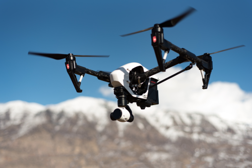
The Trimble UX5 HP is a legacy fixed-wing commercial mapping drone aimed at survey teams and geospatial professionals who care more about area coverage than cinematic flight. Based on the supplied database record, it combines a 2.9 kg max takeoff weight with 30 minutes of endurance, a quoted 52 km range, and a 140 km/h top speed. It still matters today mostly as a legacy-platform reference, a used-equipment consideration, and a point of comparison against newer mapping UAV systems.
That framing is important. This is not the sort of aircraft people browse because they want an easy weekend drone or a compact aerial camera for content creation. The UX5 HP belongs to an earlier generation of professional UAVs that were judged primarily on mission efficiency, survey workflow fit, and the practicality of turning flights into usable geospatial deliverables. In 2026, that means interest in the UX5 HP is less about chasing the newest hardware and more about answering a very specific question: does an older fixed-wing survey platform still make sense in your organization, either as a field tool, a backup system, or a benchmark against modern options?
Quick Summary Box
- Drone Name: Trimble UX5 HP
- Brand: Trimble
- Model: UX5 HP
- Category: Commercial mapping fixed-wing drone
- Best For: Surveying, mapping, and legacy Trimble geospatial workflows
- Price Range: Not publicly confirmed in supplied data
- Launch Year: Not publicly confirmed in supplied data
- Availability: Not publicly confirmed in supplied data
- Current Status: Legacy/discontinued
- Overall Rating: Not rated due to limited confirmed data
- Our Verdict: A specialized legacy mapping UAV with credible fixed-wing survey specs on paper, but it is best approached as a support, software, and spare-parts decision rather than a simple drone purchase.
- Main Buying Risk: Unknown current supportability, payload specifics, and software continuity
- Best Reason to Consider It Today: Maintaining an older Trimble-oriented survey workflow or evaluating a used fixed-wing mapping system at the right price
Introduction
Trimble positioned the UX5 HP in the commercial mapping space, and the supplied record identifies it as a fixed-wing aircraft with Belgian origin and discontinued status. That puts it in a very different category from consumer camera drones: this is the kind of platform people research for surveying workflows, geospatial data capture, fleet benchmarking, and enterprise procurement decisions.
Readers should care about the UX5 HP for two main reasons. First, older Trimble systems still appear in professional fleets, university labs, engineering firms, and on the secondary market. A drone being discontinued does not automatically make it irrelevant. In surveying and mapping, equipment often stays in service longer than in the consumer electronics world, especially if it still fits established field procedures and data-processing pipelines. Some organizations prioritize stability over novelty, and an older airframe can remain useful if the workflow around it is still functional.
Second, fixed-wing mapping aircraft remain relevant whenever teams need efficient coverage over larger sites than a typical multirotor can comfortably map. Even as multirotors have become easier to deploy and more capable, fixed-wing designs continue to offer a clear advantage in certain jobs: broad open land parcels, agricultural blocks, quarries, corridors, and other scenarios where efficient forward flight matters more than hovering flexibility. Understanding the UX5 HP helps explain how enterprise UAV mapping evolved and why fixed-wing systems still occupy a distinct place in the professional drone market.
Overview
What kind of drone is it?
The UX5 HP is a fixed-wing UAV built for commercial mapping rather than casual photography or freestyle flying. In practical terms, that means its value is tied more to area coverage, repeatable flight paths, and sensor workflow compatibility than to hovering, subject tracking, or creator-focused video features.
The supplied record shows a 2.9 kg max takeoff weight, 30-minute endurance, 52 km quoted range, 140 km/h maximum speed, 5,000 m ceiling, and roughly 1 m wingspan. Those figures point to a compact survey aircraft rather than a large heavy-lift system. They also suggest a platform designed to move efficiently through the air rather than linger over a point of interest.
That distinction matters. In the drone market, “mapping drone” can mean very different things depending on airframe type. A multirotor mapping drone is usually chosen for convenience, vertical takeoff and landing, and the ability to operate in tighter spaces. A fixed-wing mapping drone is normally chosen because it can cover more ground per flight, especially in open environments. The UX5 HP fits squarely in the second category. If your priority is hovering over structures for inspection, this is the wrong type of aircraft. If your priority is flying structured survey missions over land, it becomes more relevant.
Who should buy it?
This model is most relevant to:
- Survey and GIS teams evaluating older fixed-wing mapping platforms
- Organizations with existing Trimble-compatible workflows
- Buyers comparing used enterprise drones
- Researchers studying the evolution of professional survey UAVs
- Procurement managers assessing whether legacy equipment still has operational value
- Training institutions or labs that want a historical or practical reference point for fixed-wing survey systems
It is much less relevant to first-time drone buyers, casual pilots, or creators looking for an easy all-in-one camera drone.
A useful way to think about the UX5 HP is that it is not primarily a “buy and fly” product anymore. It is a “validate, inspect, confirm, and integrate” product. If you do not already understand the operational demands of fixed-wing UAV mapping, the support questions around retired enterprise platforms, and the importance of software continuity, the learning curve may outweigh any price advantage in the used market.
What makes it different?
What separates the UX5 HP from many consumer drones is its mission profile. A fixed-wing mapping aircraft typically trades hover capability for more efficient forward flight and better coverage per mission. The Trimble branding also places it closer to professional geospatial operations than to mainstream retail drone ecosystems.
That matters because Trimble is associated with surveying, positioning, field data, and construction technology rather than consumer aerial photography. So even without a fully documented feature list in the supplied data, the UX5 HP should be understood in the context of professional field operations, not hobby use.
Its main differentiator today, however, is not novelty but legacy relevance. Because it is discontinued, the big question is no longer just performance on paper, but whether the airframe still makes sense inside a modern support and software environment. In many cases, the real decision is not “Is this drone fast enough?” but “Can this system still be maintained, legally operated, and reliably turned into deliverables without creating more friction than it saves?”
Key Features
- Fixed-wing airframe designed for commercial mapping missions
- Trimble-branded professional platform rather than a consumer camera drone
- Max takeoff weight: 2.9 kg
- Endurance: 0.5 hr, or about 30 minutes
- Quoted range: 52 km
- Max speed: 140 km/h
- Service ceiling: 5,000 m
- Wingspan: approximately 1 m
- Compact survey-oriented footprint relative to larger fixed-wing systems
- Flight profile appears optimized for efficient forward-flight coverage rather than hovering
- Legacy/discontinued status, which strongly affects supportability and buying decisions
- Payload, camera, navigation stack, obstacle sensing, and app ecosystem are not publicly confirmed in the supplied data
A key point here is that these features describe the airframe envelope more than the complete mission system. For a mapping UAV, the sensor package, georeferencing method, mission-planning software, and output compatibility often matter as much as the aircraft itself. The UX5 HP may look reasonable on paper as an airframe, but any serious evaluation has to go beyond the headline numbers.
Full Specifications Table
| Specification | Details |
|---|---|
| Brand | Trimble |
| Model | UX5 HP |
| Drone Type | Fixed-wing UAV |
| Country of Origin | Belgium |
| Manufacturer | Trimble |
| Year Introduced | Not publicly confirmed in supplied data |
| Status | Legacy/discontinued |
| Use Case | Commercial mapping |
| Weight | Not publicly confirmed in supplied data |
| Dimensions (folded/unfolded) | Approx. 1 m wingspan; folded dimensions not publicly confirmed in supplied data |
| Max Takeoff Weight | 2.9 kg |
| Battery Type | Not publicly confirmed in supplied data |
| Battery Capacity | Not publicly confirmed in supplied data |
| Flight Time | 0.5 hr (about 30 minutes) |
| Charging Time | Not publicly confirmed in supplied data |
| Max Range | 52 km |
| Transmission System | Not publicly confirmed in supplied data |
| Top Speed | 140 km/h |
| Wind Resistance | Not publicly confirmed in supplied data |
| Navigation System | Not publicly confirmed in supplied data |
| Obstacle Avoidance | Not publicly confirmed in supplied data |
| Camera Resolution | Not publicly confirmed in supplied data |
| Video Resolution | Not publicly confirmed in supplied data |
| Frame Rates | Not publicly confirmed in supplied data |
| Sensor Size | Not publicly confirmed in supplied data |
| Gimbal | Not publicly confirmed in supplied data |
| Zoom | Not publicly confirmed in supplied data |
| Storage | Not publicly confirmed in supplied data |
| Controller Type | Not publicly confirmed in supplied data |
| App Support | Not publicly confirmed in supplied data |
| Autonomous Modes | Not publicly confirmed in supplied data |
| Payload Capacity | Not publicly confirmed in supplied data |
| Operating Temperature | Not publicly confirmed in supplied data |
| Water Resistance | Not publicly confirmed in supplied data |
| Noise Level | Not publicly confirmed in supplied data |
| Remote ID Support | Not publicly confirmed in supplied data |
| Geo-fencing | Not publicly confirmed in supplied data |
| Certifications | Not publicly confirmed in supplied data |
| MSRP / Launch Price | Not publicly confirmed in supplied data |
| Current Price | Not publicly confirmed in supplied data |
| Service Ceiling | 5,000 m |
| Wingspan or Rotor Span | 1 m |
| Length | Not publicly confirmed in supplied data |
The table tells a mixed story. On one hand, the confirmed airframe-level numbers are enough to place the UX5 HP in the fixed-wing survey category with confidence. On the other, many of the fields that matter most for a 2026 buyer are blank or unverified. That is not a minor inconvenience. It changes how this aircraft should be evaluated.
For a modern drone review, missing camera, controller, software, and regulatory details would be a major weakness. For a legacy enterprise mapping platform, those missing details become decisive. A used UX5 HP package with verified sensor hardware, working batteries, functional mission-planning tools, and complete records could be valuable. The same model name without those pieces could be a dead-end purchase.
Design and Build Quality
From the confirmed data alone, the UX5 HP looks like a compact fixed-wing survey aircraft built around mission efficiency rather than portability in the consumer sense. A 1 m span keeps it smaller than some long-endurance mapping wings, while a 2.9 kg max takeoff weight suggests a serious professional tool rather than an ultra-light recreational aircraft.
Because the supplied data does not confirm foldability, materials, landing gear design, or field assembly method, those points need verification before purchase. That matters with fixed-wing drones, since launch and recovery style can significantly affect ease of use, field safety, and site requirements. A multirotor can often be unpacked and launched with minimal setup space. A fixed-wing system may require more preparation, more attention to environmental conditions, and more discipline during recovery.
In general, a mapping-oriented fixed-wing design tends to be:
- More aerodynamically efficient than a multirotor
- Less convenient in tight operating areas
- Better suited to prepared field operations than ad hoc launches in cramped spaces
- More dependent on airframe condition and maintenance quality over time
- More sensitive to control-surface integrity and structural wear than casual buyers sometimes expect
As a discontinued model, build quality on any individual unit now depends heavily on prior use, storage conditions, battery health, and parts replacement history. For used buyers, physical condition is at least as important as the original spec sheet.
A proper inspection should go beyond obvious cosmetic wear. On an older fixed-wing aircraft, you would ideally check:
- Wing attachment points and any signs of looseness or repair
- Fuselage seams, nose section, and belly wear from landings or recoveries
- Control surfaces for play, cracking, or warping
- Servo condition and linkage smoothness
- Propulsion components such as motor mount, propeller, and wiring
- Battery connectors and charging equipment
- Signs of water exposure, poor storage, or improvised repairs
- Internal wiring quality and any evidence of modifications
These details matter because mapping accuracy depends on repeatability. An airframe that technically still flies but has minor structural distortion, vibration issues, or unreliable control response can undermine data quality long before it becomes obviously unsafe.
Flight Performance
On paper, the UX5 HP’s flight profile looks purpose-built for fast survey work. The combination of 30 minutes endurance and a quoted 52 km range suggests an aircraft intended to cover ground efficiently during forward flight, which is exactly where fixed-wing platforms can outperform many multirotors in mapping tasks.
The 140 km/h figure should be read carefully. It is best treated as a maximum speed specification, not necessarily a normal mapping cruise speed. In real survey operations, aircraft usually fly at more controlled mission speeds to maintain image overlap, capture quality, and route consistency. A drone that can sprint quickly is not automatically a drone that can map well at that pace. Survey missions typically balance speed against shutter timing, ground sampling distance, image blur, wind correction, and overlap requirements.
A few practical takeaways:
- Fixed-wing layout generally favors outdoor work over indoor operations
- It is likely better suited to open areas than confined launch sites
- It will not offer hover-based precision like a multirotor
- Wind performance cannot be judged confidently because no official wind-resistance figure is confirmed in the supplied data
- Real mapping coverage depends on altitude, overlap settings, and sensor details, not just top-line range
The 5,000 m ceiling is also an aircraft capability figure, not a statement of legal operating altitude. In most countries, lawful drone altitude limits are far lower than that. So while the number hints at robust high-altitude capability, it should not be treated as a permission to fly anywhere near that height.
There is also an important difference between quoted range and operational usefulness. A 52 km range figure may sound impressive, but in most regulatory environments fixed-wing commercial operations are still constrained by visual line of sight rules unless special approvals apply. That means the quoted figure should be understood mainly as a performance-envelope indicator, not as a guarantee of legally usable one-way operational distance. It tells you the platform is built for efficient travel through the air; it does not automatically translate into routine long-distance field use.
From a present-day perspective, 30 minutes of endurance sits in a respectable but no longer exceptional tier. It can still be useful for mapping missions, especially if the aircraft is integrated into a workflow that is already proven. But compared with newer fixed-wing systems that advertise substantially longer endurance, the UX5 HP may offer less flexibility per sortie. That does not make it obsolete by default, but it does mean buyers should calculate actual site coverage needs rather than rely on the appeal of fixed-wing alone.
Camera / Payload Performance
For a commercial mapping drone, the payload question is central, and it is also the biggest missing piece in the supplied data. No camera model, resolution, sensor size, video capability, gimbal type, or payload capacity is publicly confirmed here.
That means buyers should not assume:
- A specific RGB mapping camera
- Survey-grade geotagging performance
- PPK or RTK support
- Multispectral compatibility
- Interchangeable payload support
- A stabilized camera arrangement similar to consumer drones
- Modern trigger synchronization or advanced positioning workflows
What can be said responsibly is that a fixed-wing commercial mapping airframe only becomes truly valuable when paired with a workflow-appropriate sensor and positioning setup. In real-world procurement, the imaging payload, calibration process, georeferencing method, and software output matter more than the airframe alone.
If you are considering a used UX5 HP, verify exactly what is included:
- Camera and lens model
- Shutter type
- Geotagging method
- Calibration records
- Ground control workflow requirements
- Compatibility with current photogrammetry software
- Trigger reliability and image interval settings
- Sample datasets from recent missions
- Evidence of sharpness consistency and minimal rolling-shutter distortion, if applicable
- Whether the payload mount is original, modified, or incomplete
Without that information, it is impossible to judge the platform’s actual mapping output quality.
This is the section where legacy mapping systems often rise or fall. Two drones with similar airframe specs can produce very different business outcomes depending on payload quality. For photogrammetry, small details matter: lens distortion behavior, exposure control, trigger timing, mount rigidity, and positional metadata quality. A second-hand platform with an aging or undocumented camera may still fly perfectly yet generate results that require more ground control, more manual cleanup, or more rework than a newer integrated system.
That is why prospective buyers should request more than marketing language or a simple statement that the drone was “used for mapping.” Ask for proof. A seller who can provide recent orthomosaic results, sample raw images, flight logs, and a clear explanation of the georeferencing workflow is offering something far more valuable than a bare airframe with vague claims.
Smart Features and Software
The supplied record does not publicly confirm the UX5 HP’s software stack, flight modes, autonomy features, controller system, or companion apps. That is a major limitation because mapping drones are often judged as much by workflow integration as by airframe specs.
Given Trimble’s professional geospatial focus, software-related questions buyers should verify include:
- Mission planning support
- Waypoint or survey-grid automation
- Data export compatibility
- Integration with survey and GIS workflows
- Firmware support status
- Ground station hardware requirements
- Any required desktop post-processing tools
Features such as return-to-home, automated fail-safes, geofencing, AI tracking, obstacle avoidance, SDK access, and cloud fleet tools are not publicly confirmed in the supplied data for this model. For a discontinued enterprise platform, software availability and license status can be as important as whether the aircraft still flies.
This is where older commercial drones can become surprisingly complicated. Even if the aircraft hardware is intact, the operational chain may depend on software that only runs on older operating systems, licenses tied to obsolete hardware, or activation methods that are difficult to transfer. A seller may honestly say the system was working when last used, but if that last use was several years ago, the question becomes whether it still works in a current field environment.
A serious buyer should check:
- Whether mission-planning software still installs on supported computers
- Whether login credentials, licenses, or dongles are required
- Whether firmware files are still accessible
- Whether the controller or ground station communicates reliably with the aircraft
- Whether data export formats remain usable in current photogrammetry, CAD, or GIS software
- Whether training materials and manuals are available
In many enterprise drone purchases, software continuity is the hidden cost center. A used platform is only economical if the full workflow remains usable. If it requires unsupported laptops, outdated radios, or one specific field computer that cannot be replaced, the risk profile changes dramatically.
Use Cases
The UX5 HP makes the most sense in professional geospatial scenarios where fixed-wing efficiency is the priority.
-
Land surveying and orthomosaic creation over larger open areas
Fixed-wing aircraft are often favored when teams need to map broad parcels efficiently and do not need to hover over specific structures. -
Construction site mapping and progress documentation
On large horizontal projects, such as roadworks or industrial sites, an efficient forward-flight platform can reduce the number of sorties required. -
Mining and quarry overview mapping
Open extraction sites can suit fixed-wing operations well, provided launch, recovery, and safety planning are properly handled. -
Agricultural field mapping where efficient area coverage matters
Farms and agricultural research blocks are classic examples of environments where fixed-wing UAVs can make operational sense. -
Corridor or parcel mapping, subject to local flight rules and workflow suitability
The quoted range is relevant here in principle, but legal and operational limitations must always be factored in. -
Academic or research geospatial data collection
Universities and research groups may find value in the UX5 HP as both a working tool and a reference point in the history of UAV mapping. -
Legacy fleet continuation where organizations already own compatible Trimble tooling
This may be the strongest modern use case: keeping an established workflow operational when replacement with a fully new system is not yet justified. -
Benchmarking older fixed-wing UAVs against newer mapping alternatives
For consultants, journalists, and technical evaluators, the UX5 HP remains useful as a comparison point for how far enterprise mapping drones have progressed.
The common thread across these examples is open-area efficiency. The UX5 HP is not an inspection platform, not a close-quarters urban flight tool, and not a general-purpose aerial camera. It is most interesting where route-based coverage is the core objective.
Pros and Cons
Pros
- Fixed-wing layout is well suited to efficient area coverage for mapping work
- Quoted 52 km range is strong on paper for a compact survey UAV
- 140 km/h max speed suggests a capable airframe for transit and mission efficiency
- 2.9 kg max takeoff weight keeps it below many heavier enterprise platforms
- 5,000 m ceiling indicates a platform designed for serious outdoor operations
- Trimble branding gives it relevance in professional geospatial discussions
- Legacy workflow continuity may matter to organizations already invested in compatible tooling
- Still useful as a reference point when comparing older and newer mapping systems
- Potentially attractive on the used market if sold as a complete, verifiable package
Cons
- Legacy/discontinued status is the biggest drawback for new buyers
- Camera, payload, software, and autonomy details are not publicly confirmed in the supplied data
- 30-minute endurance is modest compared with some newer fixed-wing mapping systems
- Spare parts, batteries, and service coverage may be difficult to secure
- Remote ID and current regulatory feature support are not publicly confirmed
- Fixed-wing aircraft generally require more open-space planning than multirotors
- Unknown software licensing or activation requirements could limit usability
- Used examples may vary widely in condition and completeness
- A low entry price could hide high ownership costs if support pieces are missing
The balance here is straightforward: the UX5 HP still makes conceptual sense as a mapping aircraft, but its practical value depends almost entirely on the condition and completeness of the specific system you are looking at.
Comparison With Other Models
| Model | Price | Flight Time | Camera or Payload | Range / Coverage | Weight | Best For | Winner |
|---|---|---|---|---|---|---|---|
| Trimble UX5 HP | Not publicly confirmed in supplied data | 30 min | Not publicly confirmed in supplied data | 52 km quoted range | 2.9 kg MTOW | Legacy fixed-wing mapping workflows | Best if you specifically need this platform or Trimble continuity |
| senseFly eBee X | Enterprise pricing varies by configuration | Up to 90 min | Modular mapping payload ecosystem | Commonly positioned around high area coverage per flight | Approx. 1.6 kg class | Modern long-endurance fixed-wing mapping | Better for endurance and current-era ecosystem depth |
| DJI Mavic 3 Enterprise | Enterprise pricing varies by kit and region | Up to 45 min | Integrated mapping-oriented camera system | 15 km class transmission system | Approx. 0.9 kg class | Simpler deployment and short-to-mid-scale mapping | Better for portability, ease of use, and compact field operations |
Before reading too much into the comparison table, note that these aircraft are not direct equals in every respect. Fixed-wing drones, multirotors, and modular enterprise systems are often measured with different assumptions, especially around endurance and coverage. The point of the table is not to flatten those differences, but to show how the UX5 HP now sits in the market conversation: less as a current flagship and more as a legacy option with a specific workflow niche.
UX5 HP vs a close competitor
Against a close fixed-wing mapping competitor like the senseFly eBee X, the UX5 HP looks more like a legacy option than a current best-in-class buy. The eBee X is generally associated with longer endurance and a more modern ecosystem, while the UX5 HP’s strongest case is continuity for teams already invested in older Trimble workflows.
The eBee X also illustrates how the fixed-wing mapping segment evolved. Newer systems increasingly emphasize modular sensors, broader software support, and longer flight times. That raises the bar for any older platform. To justify a UX5 HP purchase today, the buyer usually needs a reason beyond raw specifications alone—such as existing operator familiarity, documented workflow compatibility, or a particularly favorable used-market package.
UX5 HP vs an alternative in the same segment
Compared with a multirotor alternative like the DJI Mavic 3 Enterprise, the UX5 HP represents a different operating philosophy. The Mavic is easier to deploy, easier to recover, and more practical for teams that value compact transport and simpler field work. The UX5 HP, by contrast, makes more sense when fixed-wing route efficiency is the main priority and the operator is comfortable with a more specialized workflow.
This is one of the biggest shifts in the market. Many jobs that once pushed teams toward fixed-wing aircraft can now be handled acceptably by better multirotors, especially when convenience, training simplicity, and regulatory comfort matter as much as absolute coverage. That does not eliminate the fixed-wing advantage, but it narrows the number of cases where an older fixed-wing system clearly wins.
UX5 HP vs an older or previous-generation option
If you are comparing the UX5 HP with earlier UX5-family aircraft, verify the differences at the exact configuration level rather than assuming all UX5 variants behave the same. Publicly consistent comparison data between specific legacy configurations is limited, so battery condition, payload compatibility, software status, and supportability matter more than nameplate similarity.
In other words, a well-maintained earlier variant with complete documentation could be more usable than a nominally “better” configuration sold without working batteries, software rights, or verified sensors. In legacy drone procurement, package quality often matters more than badge hierarchy.
Manufacturer Details
Trimble is both the brand and the manufacturer listed for the UX5 HP. The company is widely known as a major geospatial, positioning, construction, and field-data technology provider, with headquarters in the United States and a long-standing presence in professional surveying markets.
The UX5 HP is listed here with Belgium as its country of origin. In practical terms, that tells readers this model sits within Trimble’s international geospatial product history rather than its consumer electronics business, which Trimble does not really have in the way mainstream camera-drone brands do.
In the drone market, Trimble’s reputation has historically been strongest in:
- Survey and mapping workflows
- Positioning and geospatial integration
- Professional rather than hobby-grade deployments
- Enterprise and dealer-led sales models instead of mass retail
- Serving organizations that also use surveying instruments, field software, and construction technology
That reputation is meaningful because enterprise buyers often care about more than the aircraft. They care about whether a system fits into a broader operational ecosystem: control points, GIS outputs, CAD deliverables, field procedures, and site documentation. Even though the UX5 HP is an older platform, the Trimble name is part of why it still draws attention. It signals that the drone was designed for serious fieldwork rather than general recreation.
At the same time, brand reputation does not solve the support question. A strong manufacturer can still discontinue a product line, move on strategically, and leave older systems dependent on remaining dealers, archived documentation, and informal expertise. That is why the manufacturer story is helpful context, but not a substitute for current due diligence.
Support and Service Providers
Support is one of the most important questions for any discontinued enterprise drone, and it is especially important here. Official support, if still available at all, may be limited to legacy documentation, remaining parts channels, or case-by-case dealer assistance.
Buyers should verify:
- Whether Trimble still recognizes the model for any formal service path
- Whether regional geospatial dealers support legacy UX5-family products
- Spare parts availability, especially batteries and structural components
- Controller, charger, and mission-planning hardware compatibility
- Firmware access and activation requirements
- Any existing maintenance history from the previous owner
Independent repair shops may be able to handle generic electronics issues, but airframe-specific service is a different matter. For a mapping aircraft, lack of proper calibration or mission-system support can make a technically flyable drone commercially impractical.
It is also worth separating “repairability” from “supportability.” A technician might be able to replace a connector, servo, or motor component. That does not mean they can restore a missing mission workflow, license dependency, or proprietary communication path. Enterprise UAV systems often fail not because the airframe is beyond repair, but because one non-obvious piece of the ecosystem—software entitlement, a telemetry module, a compatible field computer—can no longer be sourced easily.
If you are serious about buying one, ask the seller and any regional service contacts very specific questions:
- Can the aircraft be demonstrated in a complete mission cycle?
- Are replacement batteries available, and in what condition?
- Is there a known maintenance interval or inspection checklist?
- Are manuals, firmware, and configuration files included?
- Has the system been sitting unused, and if so for how long?
- Can a current dealer or technician still calibrate or troubleshoot it?
These answers often determine whether the UX5 HP is a useful legacy tool or simply an interesting artifact.
Where to Buy
Because the UX5 HP is discontinued, this is not a typical consumer retail purchase. You are more likely to encounter it through:
- Used enterprise equipment brokers
- Survey firms selling retired gear
- Industrial drone resellers with legacy inventory
- Specialized auction or secondary-market platforms
- Regional geospatial dealers handling pre-owned systems
If a seller claims the system is complete, ask whether the package includes:
- Airframe
- Batteries and charger
- Ground station or controller
- Camera or payload
- Software entitlement or transfer rights
- Manuals, logs, and maintenance records
For most buyers, this should be treated as a specialist procurement decision rather than an impulse purchase.
It is also wise to ask for evidence that the system functions as a system, not just as a list of parts. A complete package is more than boxes on a shelf. Ideally, you want recent photos, serial numbers, battery information, proof of software access, and if possible a demonstration flight or recorded mission workflow. If in-person inspection is impossible, request detailed close-ups of the airframe, electronics, connectors, payload mounting points, and any included ground-control hardware.
Good sellers of enterprise equipment usually understand this level of scrutiny. If a seller cannot explain what is included, how the system was last used, or whether software can be transferred, that uncertainty should be priced into the deal—or treated as a reason to walk away.
Price and Cost Breakdown
No reliable launch price or current price is publicly confirmed in the supplied data for the UX5 HP. That means budgeting has to go beyond the airframe itself.
Before buying, verify the total ownership cost of:
- Airframe condition and completeness
- Replacement batteries
- Charger and power accessories
- Controller or ground station hardware
- Included camera or sensor package
- Mapping and post-processing software requirements
- Spare parts and repairs
- Shipping, import, and insurance costs
- Pilot training and operational setup
With a legacy enterprise drone, a low purchase price can still turn into a high-cost project if batteries are exhausted, software is unavailable, or a missing payload must be sourced separately.
This is where buyers sometimes get caught. A used enterprise drone can look inexpensive compared with a current-generation mapping system, but the headline purchase price may be the least important number. If you need to replace proprietary batteries, source a missing camera, obtain legacy-compatible computing hardware, train staff on an unfamiliar workflow, and absorb downtime while troubleshooting, the apparent bargain can disappear quickly.
A better budgeting approach is to think in scenarios:
-
Best-case scenario:
The aircraft is complete, documented, and demonstrably operational. In this case, a legacy purchase may offer a cost-effective way to continue a niche workflow. -
Middle-case scenario:
The airframe is good, but batteries, software access, or payload components need attention. Here the economics depend on your internal technical capacity. -
Worst-case scenario:
The aircraft flies, but the full mapping workflow cannot be restored reliably. At that point the system may have limited value beyond parts, reference, or experimentation.
For commercial users, cost should also be measured against risk. An unreliable mapping platform can cost far more in missed deadlines, repeat flights, and uncertain outputs than a more expensive modern system with better support.
Regulations and Compliance
At 2.9 kg max takeoff weight, the UX5 HP is in a class that will trigger registration, operational, and pilot-certification requirements in many jurisdictions. Exact rules depend on country and use case, especially for commercial mapping work.
A few practical compliance points:
- Commercial use usually requires more than basic recreational rules
- Fixed-wing operations often need more launch and recovery space than multirotors
- Visual line of sight rules may limit how much of the quoted range is legally usable
- Remote ID support is not publicly confirmed in the supplied data
- Privacy, land access, and data-capture permissions must be checked locally
- The 5,000 m service ceiling is not the same as a legal flight-altitude allowance
Always verify current local rules before operating any legacy enterprise UAV, especially if you plan to use it for paid survey work.
The regulatory question is especially relevant for older aircraft because compliance expectations have changed over time. A platform that was acceptable in its original market context may now face new requirements around electronic identification, operator competency, maintenance logging, airspace awareness, and operating procedures. Even if the aircraft is technically sound, the burden of compliance may be higher than with a newer system designed around current rules.
Fixed-wing operations can also raise practical compliance issues beyond the aircraft itself. Launch and recovery zones must be appropriate, bystanders may need to be kept farther away, and the inability to hover can make contingency planning different from what multirotor operators are used to. If your work regularly happens near structures, roads, or mixed-use sites, the operational simplicity of a multirotor may outweigh the theoretical efficiency advantage of a fixed-wing platform.
In short, legal use is not just about whether the drone can fly. It is about whether the complete operation—site selection, launch, recovery, identification, pilot qualification, and data collection—fits current rules in your jurisdiction.
Who Should Buy This Drone?
Best for
- Survey professionals comparing or maintaining older fixed-wing mapping systems
- Organizations with existing Trimble-oriented geospatial workflows
- Buyers who understand legacy enterprise drone support risks
- Researchers and journalists documenting the evolution of commercial mapping UAVs
- Used-equipment shoppers who can inspect hardware thoroughly before purchase
- Teams with internal technical staff capable of validating software, batteries, and payload configuration
- Operators working in open-area environments where fixed-wing efficiency still has practical value
This is a product for informed buyers, not casual shoppers. The best candidates are those who already know what they need from a mapping UAV and can assess whether the specific system being offered still meets that need.
Not ideal for
- First-time drone buyers
- Users who need guaranteed modern app support and simple setup
- Creators looking for a camera drone for photo or video work
- Operators who need clearly documented Remote ID and compliance features
- Teams without access to spare parts, software validation, and technical support
- Anyone wanting the convenience of a modern foldable multirotor
- Organizations that cannot tolerate downtime or workflow uncertainty
- Buyers who only care about headline range and speed figures without evaluating the full mission system
For these users, the UX5 HP introduces more complexity than value. The drone’s historical and technical interest is real, but that is not the same thing as being the right tool for a modern field program.
Final Verdict
The Trimble UX5 HP is best understood as a legacy fixed-wing mapping platform with respectable core airframe numbers but too many unknowns for a blind recommendation. Its biggest strengths are its mission-oriented design, quoted 52 km range, fixed-wing efficiency, and relevance to professional survey history. Its biggest drawbacks are equally clear: it is discontinued, key payload and software details are not publicly confirmed in the supplied data, and long-term support may be the real deal-breaker.
If you already operate in a Trimble-adjacent geospatial environment, the UX5 HP may still be worth considering as a used or reference platform. That is especially true if the package is complete, demonstrably functional, and supported by records, software access, and known maintenance history. In that kind of narrow, well-validated scenario, a legacy fixed-wing aircraft can still deliver practical value.
If you are buying fresh for active field deployment, though, newer mapping drones with better-documented sensors, compliance features, and support ecosystems will usually be the safer choice. The UX5 HP is not impossible to justify, but it demands a very specific buyer: someone who understands that the real purchase is not just an airframe, but an entire operational chain. If that chain is intact, the drone can still be meaningful. If it is not, the attractive spec sheet becomes much less important than the time and cost required to make the system usable again.